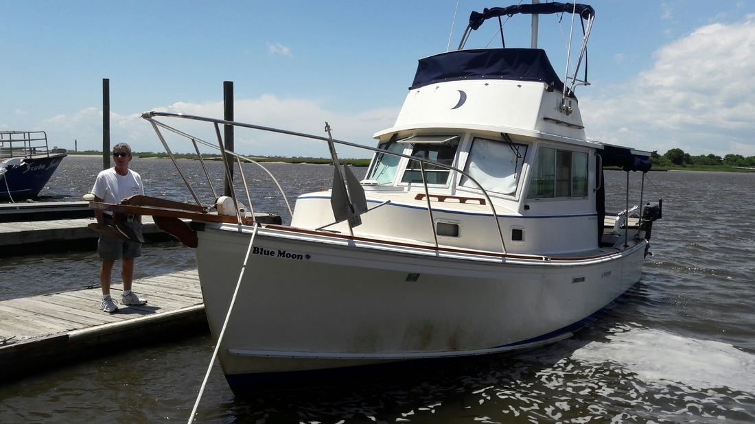
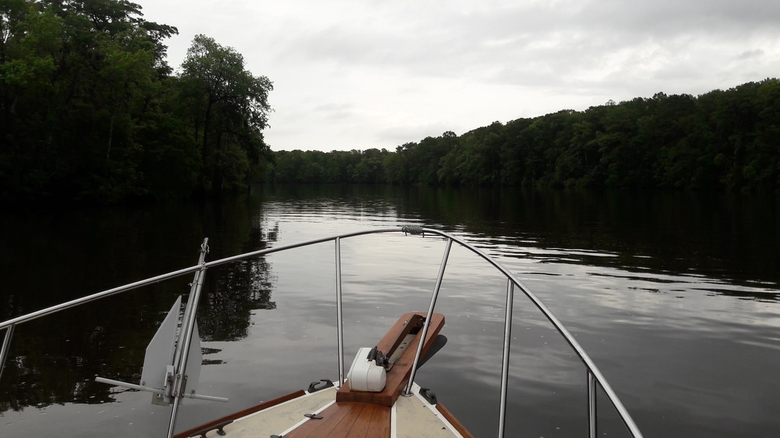
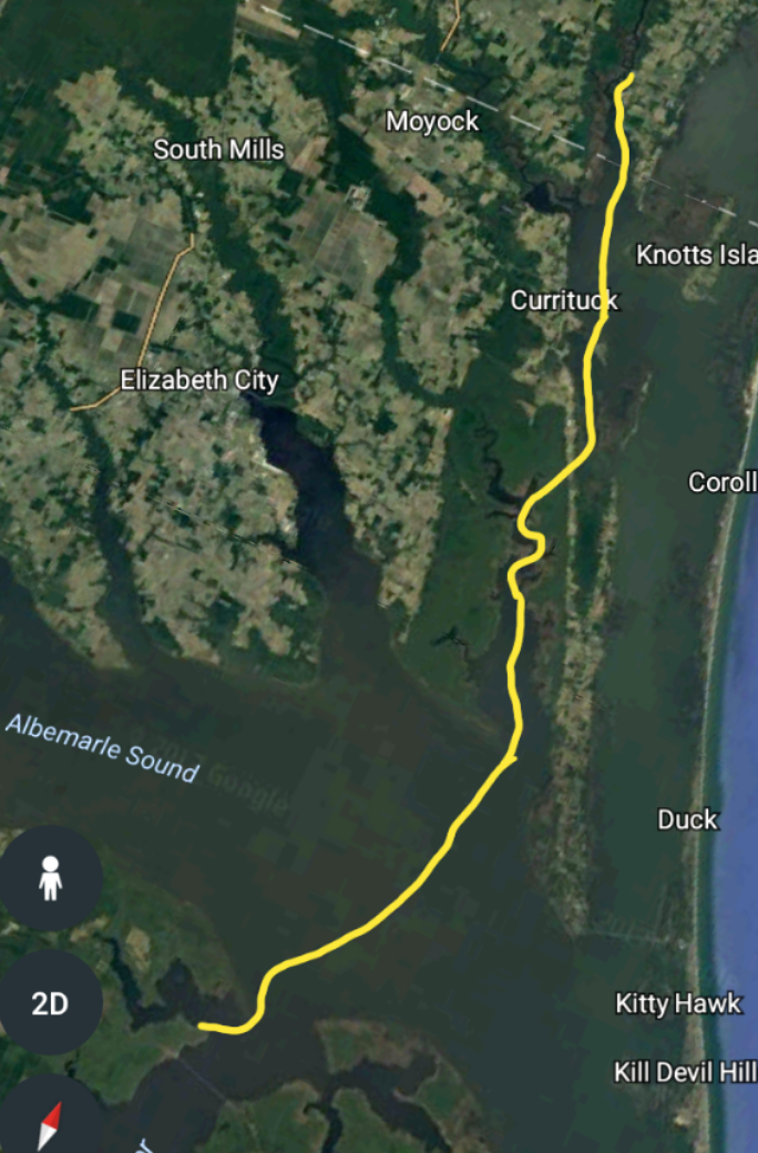
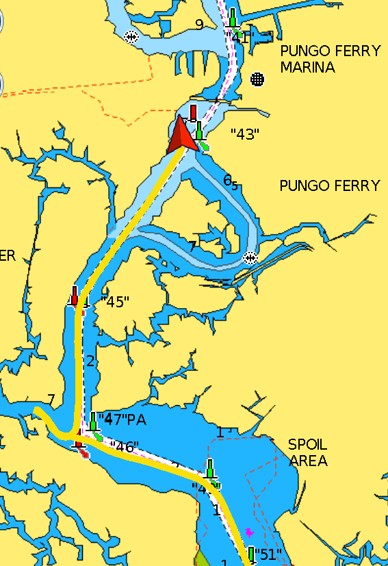
  Blue Moon in Pungo Ferry It was a nice night at anchor...calm waters and perfect temperatures. We both slept very well. We awoke at 5:40 and were on our way 15 minutes later. The weather forecast was for 80% chance of thunderstorms at 14:00 and we wanted to be anchored by then. We would be crossing the Albemarle Sound which is about 15 miles wide. It can get quite nasty if the wind picks up or if it's blowing from the east. This morning we had a 7-10kt west wind blowing. Even though the winds were light, there were still 2ft swells on our stern quarter causing Blue Moon to rock and making eating breakfast underway difficult. Since we left Wrightsville Beach, our wireless internet has been sparse, and mostly non-existent. This morning, in the middle of the Albemarle Sound (far from any land) our internet returned and the signal was strong. Go figure. We had two possible anchorages picked out for today and another one, just as a back up. The first one, Buck Island was only 20nm away, but wasn't protected for today's wind direction. So we continued 23nm further, into Virginia, to the second anchorage, Blackwater Creek. At 13:00, we arrived at our second option. After two attempts and not even a hint of it grabbing, we decided to move a mile up the ICW to Pungo Ferry (Plan C). This time, the anchor set immediately. Once we were settled, Matt went to work on boat repairs. Something always needs to be repaired on a boat. Since I now had internet, I was able to do research for our next several weeks of travel. These last five weeks of cruising have been relatively easy since we've traveled this path before. Once we pass the Chesapeake, everything will be new to us and thus a lot of research is needed before we get there. The afternoon flew by and at 5:30, we realized that we'd almost missed Happy Hour. For dinner, Matt cooked up some chicken marsala which was very good. It never did rain and ended up being a very pleasant, sunny day. Trip Log-Day 31: 49nm, 7.5 hours, Trip Total: 1012nm, 158.25 hours, 256 gal diesel. 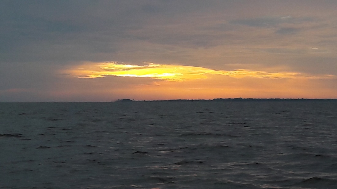 Yet another sunrise. 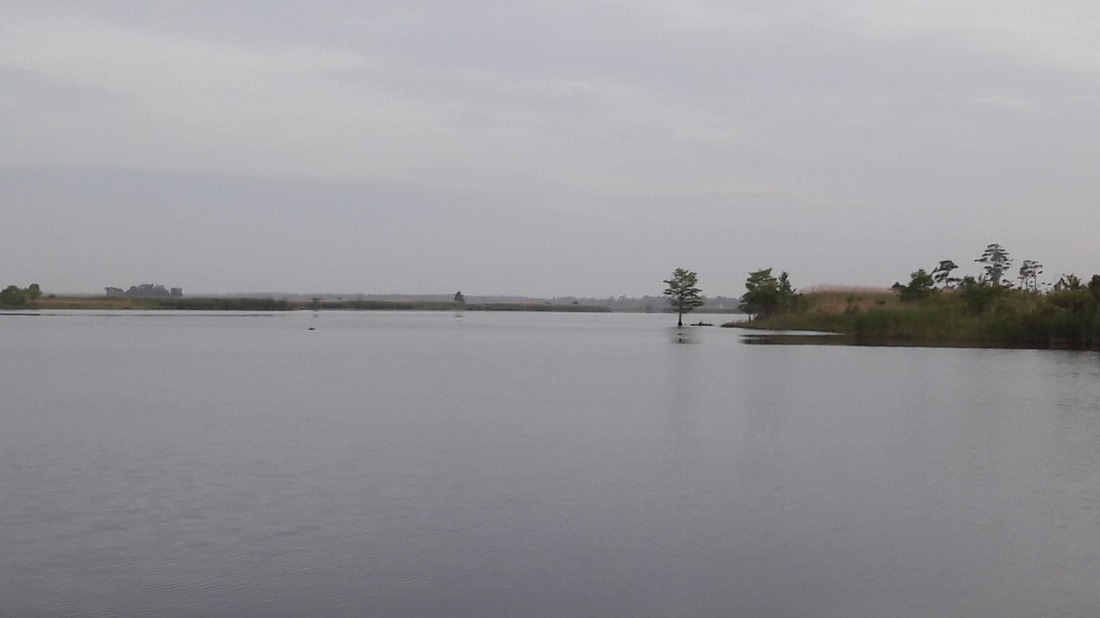 Tonight's view from Blue Moon's porch
0 Comments
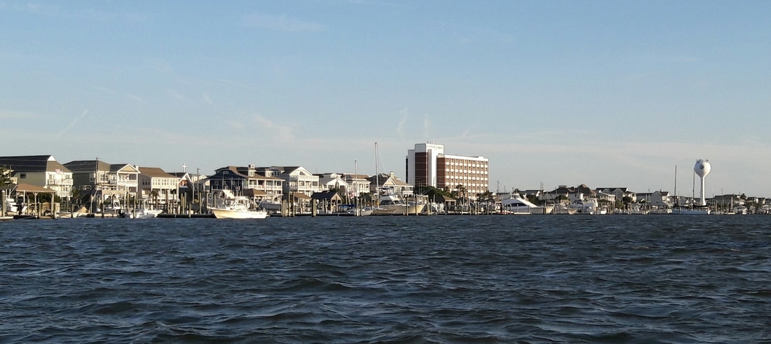
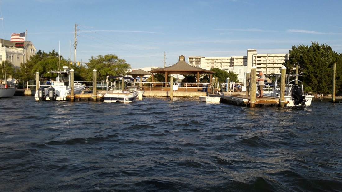
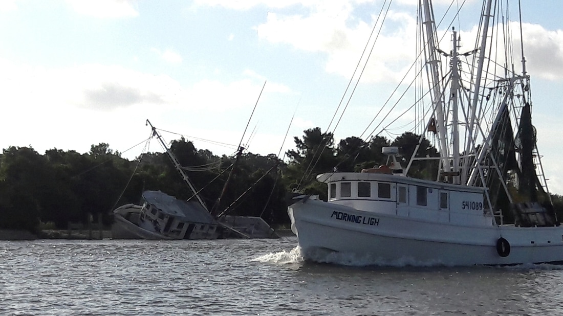
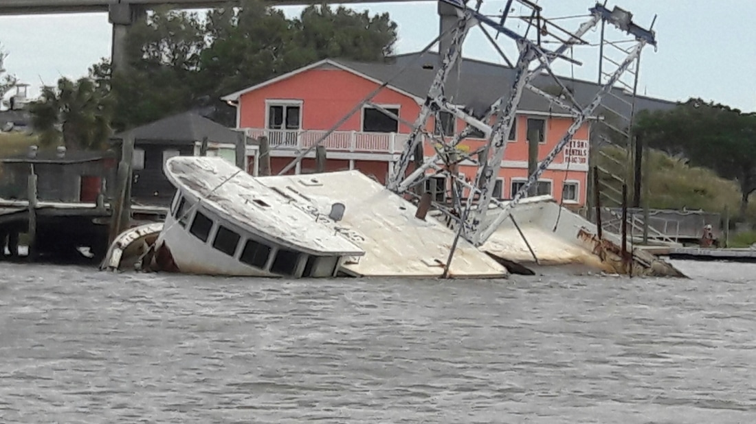
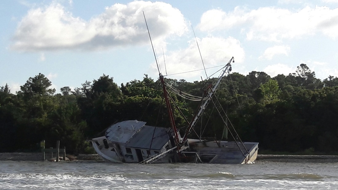
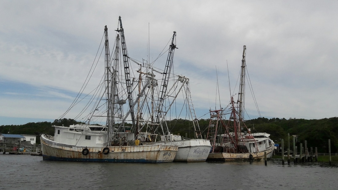
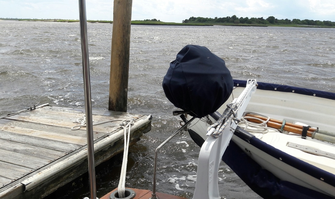
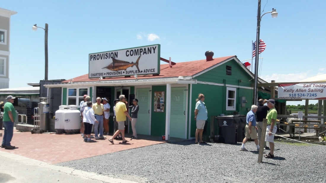
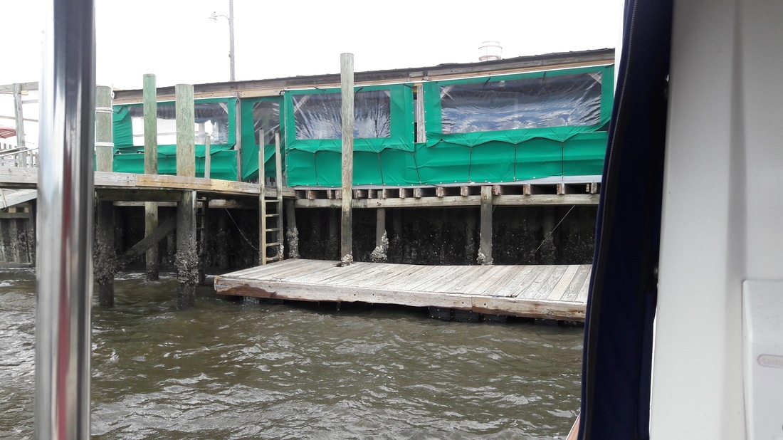
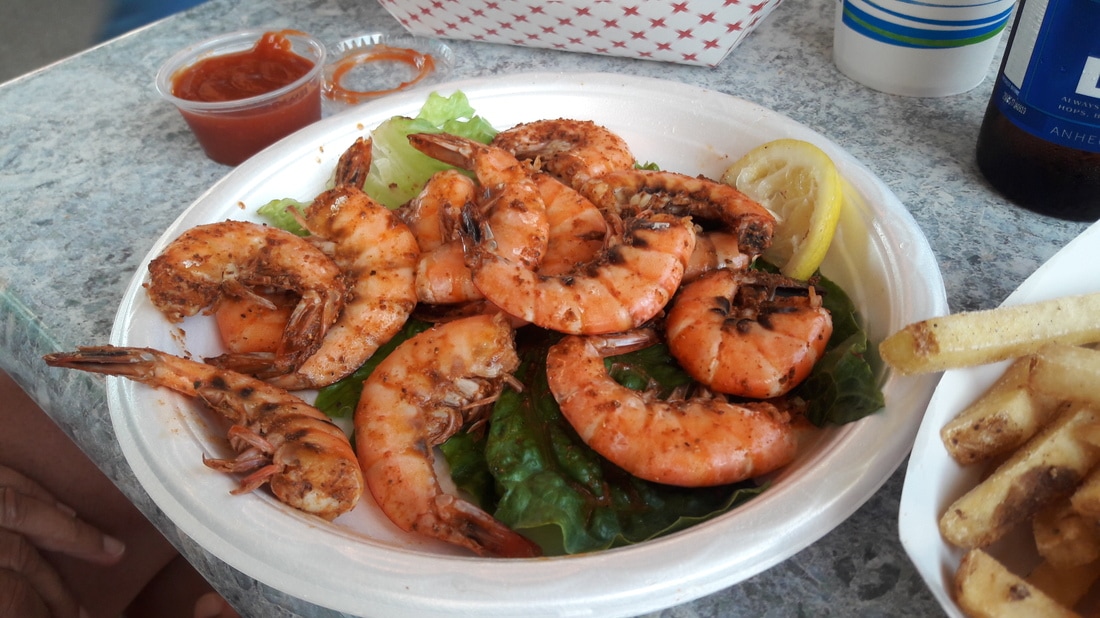
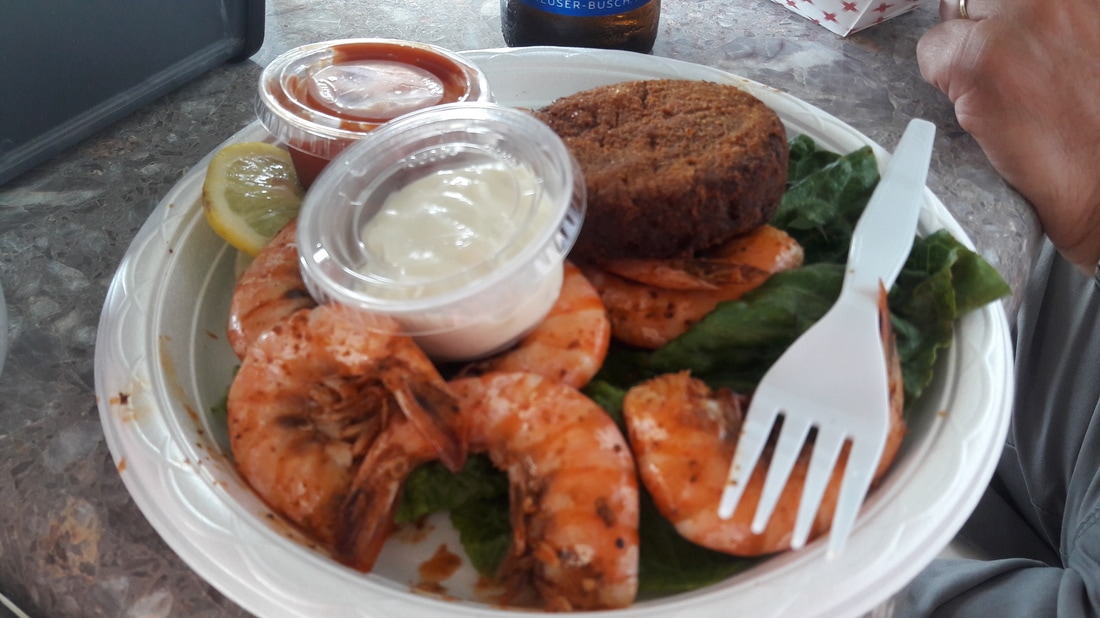
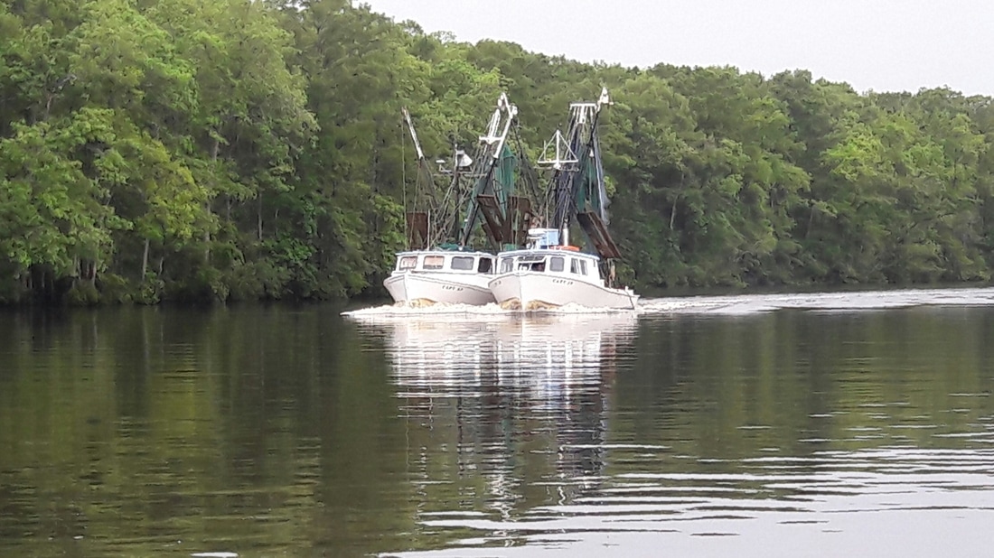
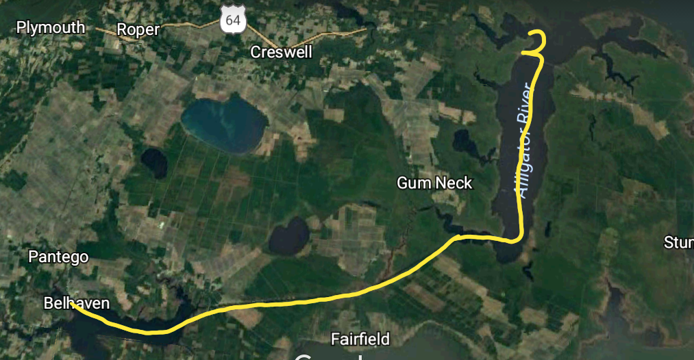  Blue Moon stopped in Alligator Marina for fuel then anchored in Little Alligator River At 1:30am, sprinkles of rain on our faces woke us both up. Matt jumped up to close the hatch above us and I went to close the windows in the main salon. It rained, it thundered and the wind blew for about an hour, then it stopped. Then we had another storm cell quickly pass over us at 5:00. At 5:45, we decided to get up. I got dressed then went to town looking for a wifi signal. At 6:00, I was slowly walking on Main St looking at my phone. I was getting strange looks from several locals out walking their dogs. I did manage to find a weak signal and was able to check today's weather forecast, but not strong enough to post yesterday's blog, I returned to the boat to report to Matt, who was getting the boat ready for our departure, that it was a"go". We may get caught in a shower this morning, but for the most part we will be protected from strong winds if a storm cell hits us. We were off the dock at 6:20 and headed to the Alligator River-Punga River Canal. This route is a very isolated, but a pretty ride. At 13:30, as we were going down the entrance channel of Alligator Marina, we encountered a 15+ft tree floating in the middle of the channel. We always have to be on the lookout here on the Alligator River for floating logs. Once we were secure on the the fuel dock, Matt got busy filling Blue Moon's fuel tank. The dockmaster told us that they just bought the marina on Friday and that they had big plans for it. While Matt continued pumping fuel, I went looking for the wifi password at the marina. Once I got that, I posted yesterday's blog, and checked email, while helping Matt with the fueling. Today, we took on 72 gal of diesel at $2.10/gal. That we our biggest fill-up ever. Our tank holds 120 gal, but Matt doesn't like it to get it more than half empty Soon we were on our way again. We went another couple miles to anchor in the Little Alligator River. Our first two attempts failed. The anchor was just skimming across the bottom. We moved a half mile, and dropped it again. This time it caught right away. Matt put Blue Moon in reverse and tugged on it. It was in there good this time. The remainder of the afternoon was spend on Blue Moon's porch reading and relaxing. All day, it was threatening to rain although all we got was an occasional sprinkle. This gray, cloudy weather had put us in the mood for Mattatoui (a stew of tortellini with vegetables and spaghetti sauce). It's another good gloomy day meal. At 5:00, the skies cleared and the sun came out. Ok...Mattatoui is also a good fair weather dinner. Little Alligator anchorage was a good place to spend the night...very peaceful. By 9:00, we both were ready to go to bed. Trip Log-Day 31: 52nm, 8 hours, 72 gal diesel Trip Total: 963nm, 150.75 hours, 256 gal diesel. 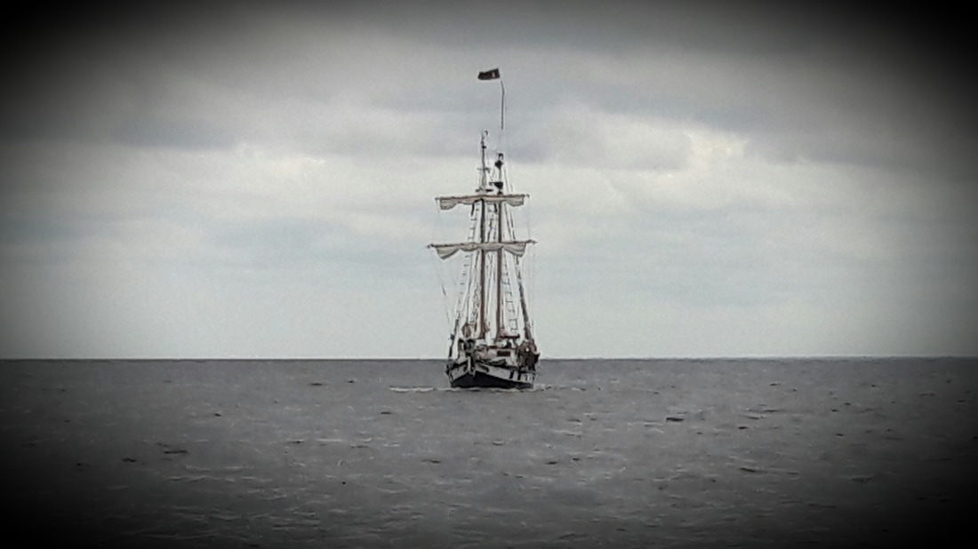 As they say in The Princess Bride... "I think we bring followed.... Inconceivable".   It started to get light at 5:30, so we naturally woke up. Waking up at that hour, not only enables us to get on our way early but we get to see great sunrises. At 5:55, we were pulling up anchor and heading east on the Neuse River. There was a light breeze from the west. This was perfect, as the Neuse River can be very uncomfortable during an E or NE wind due to the 55nm fetch from the Outer Banks. We arrived in Belhaven at 11:45 and went to the empty "free dock". Five years ago, the dock was free, but now the town is charging $1/ft for an overnight stay. I tried to telephone the Dockmaster to find out how to pay, but I didn't have cell phone service. Then I tried to hail him on the VHS radio. A nearby marina answered and said that the Town Dockmaster would be there later in the day to collect the money. The docks now have power ($5 extra) and water. We filled up Blue Moon's water tank and our drinking water jugs. Then Matt got to work on some of his boat chores. I went looking for a laundromat. I asked a local and found out that there used to be a laundromat in Belhaven a long time ago, but not any more...oh well. Then I asked if there was a pizza delivery place. No, not here in Belhaven. Not many businesses here. They do have a Ace Hardware which we visited numerous times today. I also was able to find some unsecure wifi from the "call center" (whatever that is) which I used to post my blog and to check our emails and the weather. For dinner, we had a strong hankering for pizza and since the pizza couldn't come to us, we'd have to go to it. We walked 1.4 miles to Vinnie's Pizza. It was just a pizza shop, not really a restaurant. They didn't sell beer and the pizza was "good enough" to get rid of our pizza hankering. After pizza, we walked back to the boat. When we were here five years ago, the town was struggling to survive and it still is. Nothing has changed. There is not much here to make it worth a stop, except that it's a place to rest for the night. When we got back to Blue Moon, we found out that the Dockmaster has been around to collect his $28. He left a form for us to fill out and an envelope. We walked over to the municipal building and dropped our check in the evening deposit box. Back on Blue Moon, we enjoyed a cold beer and just chilled on our "porch", as a local called it. Trip Log-Day 31: 41nm, 6 hours, Trip Total: 917nm, 142.75 hours, 184 gal diesel.  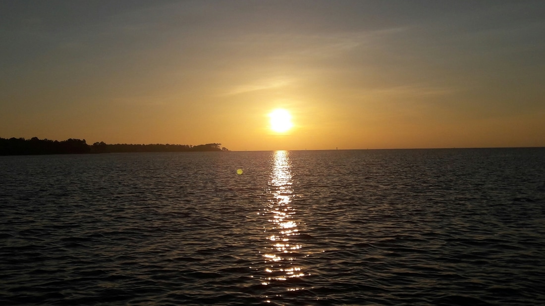 More sunrises    part 1-LeJeune to Cedar River 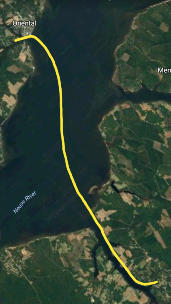 part 2-Cedar River to Oriental We awoke at 5:30 this morning and were awarded with an amazing sunrise. We had a long day planned and wanted to be on our way before the holiday boaters got on the water. \nWe started to pull the anchor up at 5:55. The chain was covered with black silky mud, yet the anchor came up with gray clay-like mud. Looks like there are two different types of mud in this anchorage. \nOnce the chain was rinsed and stowed, we were on our way. \nAt 6:30, we were approaching Onslow Bridge which has a vertical clearance of 12ft. It opened every hour and half hour from 7:00am-7:00pm. But we knew from past experience that it is on "request" at other times. The cruising guide gives the impression that it's closed before 7:00am, but we knew better. At 6:35, we called the Onslow bridgetender and he opened it right up for us. \nIt is important to get through that bridge by the 7:30 opening, as the Marines can and frequently do shut down the ICW for artillery practice. If that happened, it would be closed for about 3 hours. Being a holiday weekend, we didn't think that they would close it... but we weren't taking any chances. Last time that we went through this area, they did close it. Boaters, who arrived for the 8:00 opening, had to wait the three hours or go back to take the outside route. \nIt was beautiful morning to be cruising the ICW, until 11:00. That's when the ICW went crazy. It was like cruising in the Miami area on a weekend, but instead of cigarette boats full of bikini clad girls, there were fishing boats full of families. It was 10 times worse than the Miserable Mile on a winter vacation weekend. \nWe decided to skip Beaufort (Bo-fort) on this trip since we've visited there before and it wasn't worth the hassle. The "anchorage" is full of permanent boats, the current is very strong and the marina is expensive (and not very good). To top it off, due to the holiday weekend, the harbor would be congested with holiday boaters and their wakes. \nSo we continued 15 nm more to the Cedar River. Five years ago, we had spent several days at this anchorage during the Memorial Day weekend, as Hurricane Beryl passed by. \nAt 13:00, we arrived at Cedar River. The wind was blowing 11-14 kts with gusts to 17 kts. In addition, it was pretty wavy due to the long fetch. It wasn't what we'd call "a good anchorage" for tonight, although there were two yachts anchored here. We dropped the anchor, then checked the last weather report that I had received this morning. The wind was suppose to increase a bit this afternoon, before it decreased in the middle of the night. \nAfter we cleaned the salt off the windows and stainless, we questioned why we anchored here and decided to look for another option. \nWe lifted the anchor and headed to Orient about 7nm away. We knew that Orient would be crowded and that the free town dock would be full but we were confident that we could find a place to drop the hook. \nWe arrived at Orient at 3:00 and checked out both of the free town docks. They were both full and the main anchorage was not protected from the strong SW winds. So we went under the 43 ft bridge and found a place out of the channel that gave us protection from the wind. \nOnce settled, we lowered the dinghy and headed to the town dinghy dock. Since it was so windy and wavy, the dinghy ride seemed much longer than it actually was. \nOnce in town, we stopped at Provisions, the local marine store, because that's what you do when you're traveling on a boat. Our next stop was to The Bean. It is a very, very small coffee/ice cream shop. It was packed with townspeople and visitors. We had some ice cream (#11 ice cream) and I was able to check our email with their internet. \nAfter the ice cream, we returned to Blue Moon in time for Happy Hour and dinner on her lido deck. \nTrip Log-Day 31: 58nm, 8.25 hours, \nTrip Total: 886nm, 136.75 hours, 184 gal diesel. \n Sunrise at Camp LeJeune 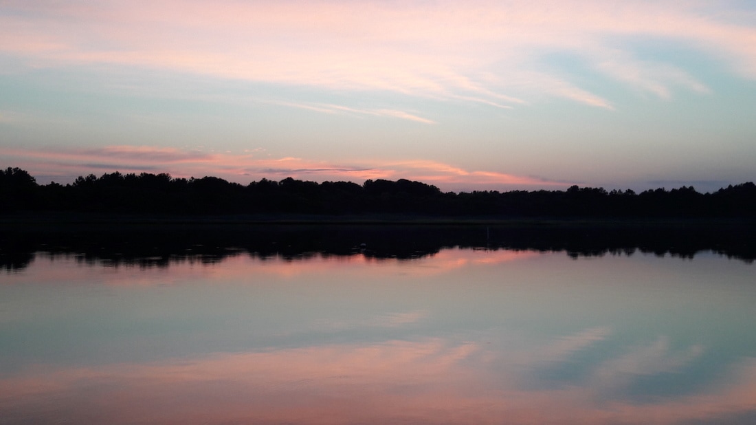 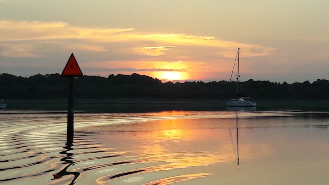 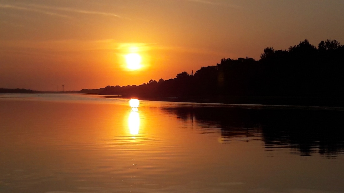 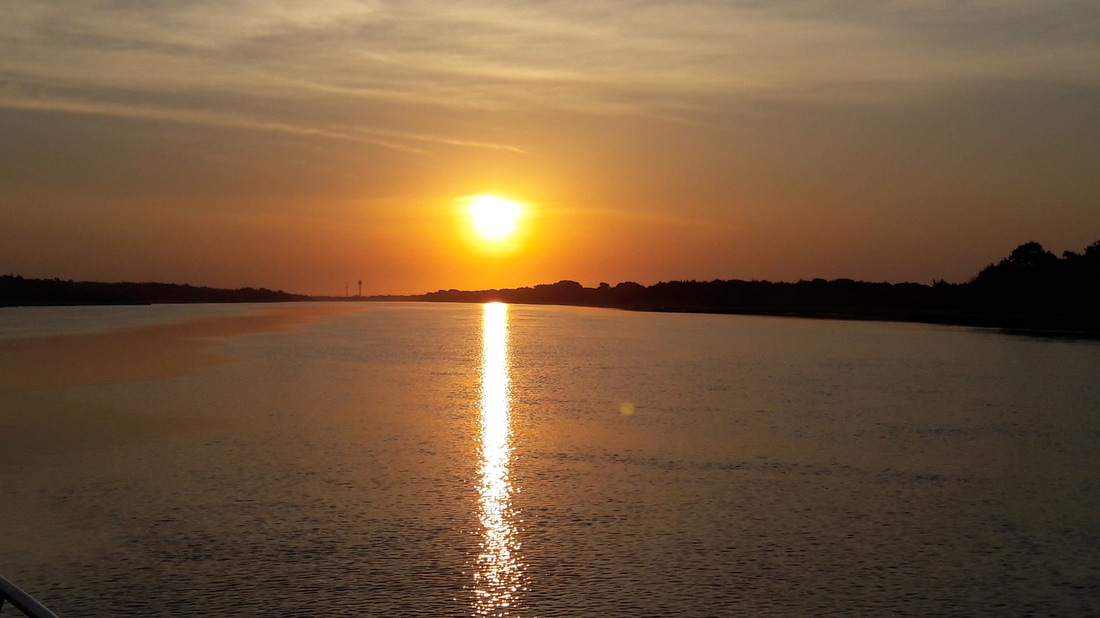 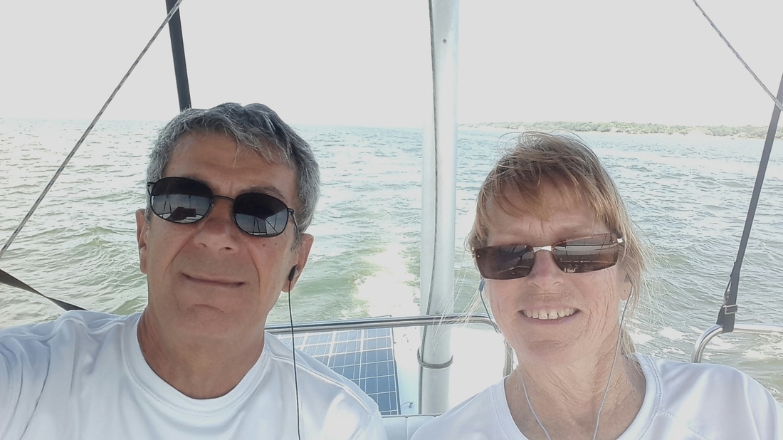 us on the fkybridge 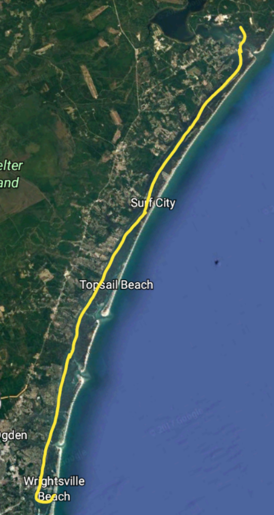 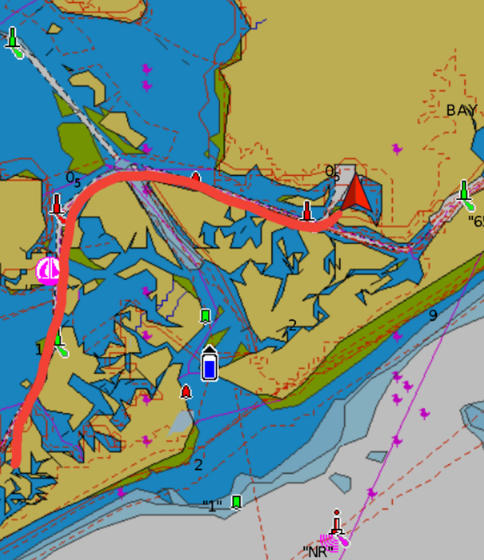 Blue Moon at the Camp LeJeune anchorage We were on our way by 6:20. The first bridge had 17 ft vertical clearance and Blue Moon's height is about 16ft. No problem. At this early hour, the ICW was pretty empty except for the occasional fishing boat. It was a nice day to be on the water. As I was looking in the cruising guide, I noted that Surf City bridge would need to be opened for us to pass and that it opened only once on the hour. We used the timer feature on our GPS and saw that if we wanted to make the 9:00 bridge opening, we would have to average 8.62 kts. That is faster than our usual cruising speed. If we wanted to make the 10:00 opening, we would have to average 5.62 kts. That is slower than we usually cruise, which is 6.5 to 7.5kts. We decided to go for the 9:00 opening. If we needed to, we would go fast (12kts) for a short time to get to the bridge in time. We generally don't go the 12-15 kts that she is capable of, as it to triples our fuel consumption. The tide was good to us and we rode it most of the way with our speed averaging 8-9 kts. We arrived at the bridge at 8:58. I started calling the bridge tender a mile from the bridge. I wanted to let him know that we would be there for the 9:00 opening but he never answered. When we reached the bridge, we could see that there were 3 other boats waiting for the opening, so we didn't worry about contacting him. Once we were through the bridge, I read my blog from five years ago. Apparently, we had the same problem with contacting the bridge tender. I had noted in the blog that the bridges north of Florida monitor channel 13, not channel 9 as they do in Florida. This is the first bridge that we've had to be opened for us since we left Florida, and we had forgotten this fact. The lesson I learned is that I must read my old blog everyday so we don't make the same mistakes that we did five years ago. We arrived at the Camp Lejeune anchorage at 10:45. The US Marines own this property but they allow people to anchor here. If they plan to use this area for manuveurs, that we could be chased out, even in the middle of the night and the are no nearby anchorages When we were here before, we were able stay and watch the Marines night time helicopter manuveurs. We're hoping since it is Memorial Day weekend, there won't be any manuveurs going on. In this anchorage, there is a couple feet deep of soft mud, then under that, there is a harder bottom with good holding. Our first attempt to get the anchor to hold was unsuccessful The second time, we dropped the anchor and allowed it to settle into the soft mud. Then Matt put Blue Moon in reverse and gently pulled on the anchor. It was holding, then it wasn't, then it was again. We pictured it plowing down through the soft mud until it got a hold on the door mud. Matt then increased the engine RPMs and thus the tension on the anchor rode. This time it held. It is probably buried 2-3 feet in mud. I have a feeling that tomorrow morning, we will be pulling up a very muddy anchor. Once anchored, Matt went to work changing Blue Moon's oil. This is the 1st of 3 that he anticipates having to do this summer. An hour and fifteen minutes later, he was on to another project. A board on the rail of the dinghy had separated from the dinghy. So he reattached it. The marines never kicked us out, but five more boats joined us in the anchorage (8 boats total). All five boats had difficulty getting their anchors to hold. One sailboat took 6 attempts before they were satisfied. After a long day on the water, the last thing you want is to have difficulty anchoring. As a bonus, they were anchoring in 15kt(and gusting) winds. We felt bad for them. Later, we enjoyed a few beers on Blue Moon's lido deck. Matt fired up the barbie and cooked some pork tenderloin for dinner. Tomorrow, we need to be on our way by 6:00, so we went to bed early. Trip Log-Day 31: 35nm, 5hours, Trip Total: 828nm, 128.50 hours, 184 gal diesel 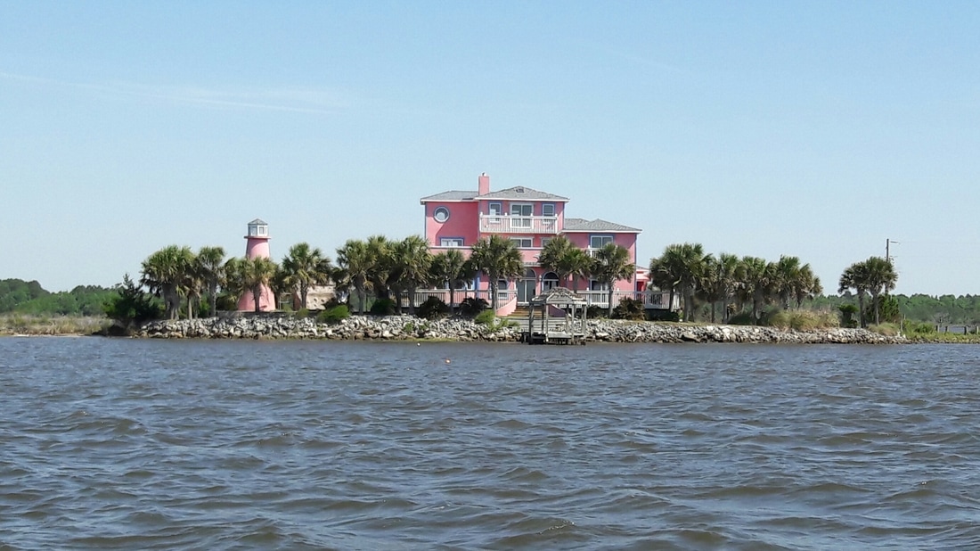 A house on it's own island on the ICW. 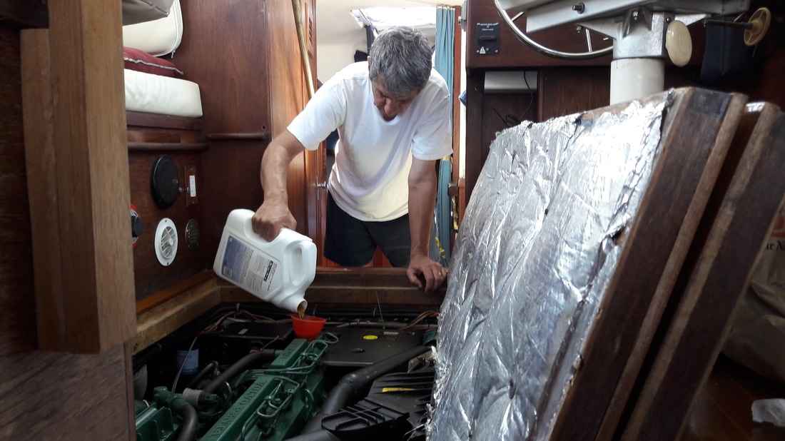 Mechanic Matt changing the oil 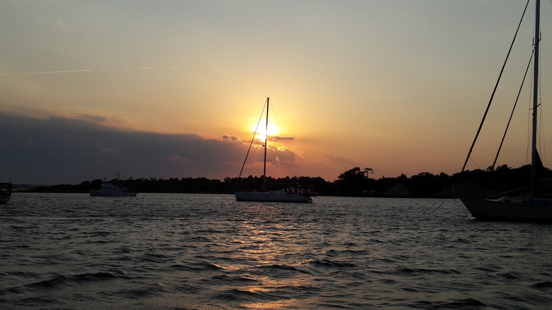 Sunset at Camp LeJeune 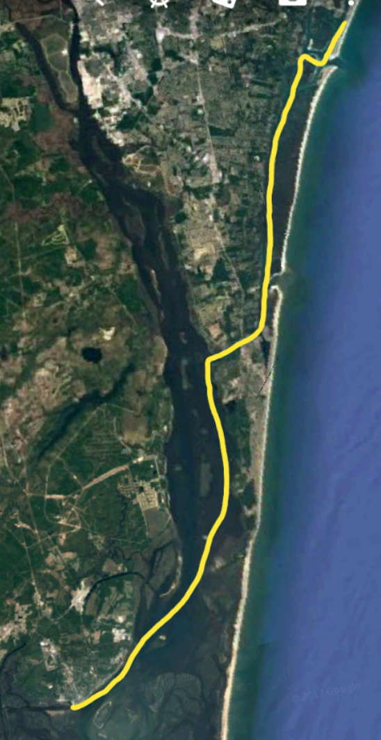 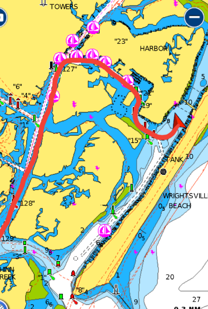 The winds decreased during the night, so we both were able to get a good night's sleep. We woke up at 6:15 and the wind was down to 8-9 kts on our stern, and the tide was quickly coming in. We decided to go before the wind picked up as was predicted. By 6:30, we had untied the lines and was out of the slip. That manuveur went smoothly and soon we were riding the tide up the Cape Fear River at 9 kts. At 10:00, we arrived at Wrightsville Beach. Our first two attempts at setting the anchor were unsuccessful. But after we moved over a bit, we were able to get it to hold. At noon, we dinghied to shore and tied up at the public dock. Our first stop was to our favorite frozen custard shop in town, but sadly it was not there. We remembered how good their custard was and were looking forward to having some. I did find another custard shop, Kohl's Frozen Custard which was good, but not nearly as good as the one that we had 5 years ago. After indulging in the frozen custard, we walked two miles to the hardware store. Matt needed to pick up a couple things there. Then we crossed the street to Harris Tweeter grocery store. It would be a couple days before we had another chance to pick up fresh produce and OJ. We then walked the 2 miles back caring all our goodies that we had purchased. It felt good taking the long walk m Back on the boat by 3:30, it was time to store the provisions and chill. Later in the day, we dinghied back to shore for dinner. We went to Jerry Allen Sports Bar and Grill. We had been there before and enjoyed it. It's pretty rustic, but the food was very good. As a bonus, today almost everything on the menu was half price. Good deal. Trip Log-Day 31: 24nm, 4 hours, Trip Total: 793nm, 123.50 hours, 184 gal diesel.   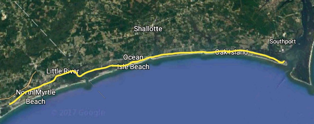  It was a windy rainy night and cool enough, that we were comfortable with the windows shut. But we awoke to another sunny day. At 6:45, there was a slight tidal current and light winds blowing as we left the slip. We continued north and soon crossed the state line into North Carolina. As the morning progressed, the wind increased, but it was on our stern, so it wasn't bothering us(and we really didn't notice the increase). We arrived at Southport at 12:15. We planned to tie up at the Provisions Company restaurant. If you eat there, you can spend the night on their free dock. They have 3 floating docks and 2 slips with pier dock. As we approached the dock, we now felt the effect of the wind. It was blowing 20+kts and gusting. Between the fast moving tidal current and the intense wind on our stern, Matt was having a hard time making Blue Moon do what he wanted. Since there were no other boats at the dock, I telephoned the restaurant. I found out answers to our questions. Yes, we could still stay on the dock overnight for free and no, the docks were not damaged by Hurricane Matthew. As the wind continued to increase, we thought of alternate plans. When we were in Vero Beach Marina, I had talked to a woman from Southport. We had told me that if the docks were full, that we could anchor in the area just off the docks. We checked it out and found 10 ft of water. But with the tide going up 6ft more, the area was too small to put out an appropriate amount of anchor rode for these conditions. Our other option was to go back a mile or two, to a little creek that we saw. It would be easy to anchor there, but it was too far to dinghy to town in this wind. Just then, two guys who worked at the restaurant came out to help us in. I put the lines and fenders out as Matt tried to get Blue Moon to the dock. The swift tide was taking her sideways and the 20kt wind was blowing her to the dock, all at the same time. When he got her close enough, I threw the strong young guys the lines and they pulled her to the dock and secured her. We tipped them, more than we usually do, for their efforts. They said that they would ring the tip bell and split it with the staff. Matt and I agree that this was probably the most difficult and terrifying docking experiences that we've ever had. Now I needed an ice cream. We headed into town to where our favorite ice cream place was 5 years ago, but now it is a salt water taffy store. This made me very sad. We did manage to find another one, Spike's Diary Bar. As we were crossing the street, I was so focused on the ice cream shop, that we came close to being hit by a car. By this time, I really needed an ice cream. (#10 ice cream) We checked out the local shops then returned to Provisions for a snack and a beer. We split the lunch special of shrimp and a crab cake and planned to come back for dinner. Later, as we were sitting in Blue Moon relaxing, the sky turned black. We could see a wall of water coming down the ICW toward us. The wind picked up and the waves increased, ferociously hitting our stern. The highest gust that we saw was 37mph, but the restaurant manager said "50 or 60 mph". We had no damage except for my nerves. The restaurant's metal patio roof lifted several inches and a wall piling on the patio was moved 6 or so inches. They had 20 customers on the patio when the squall hit. The whole area lost it's power. So now we beginning to understand why they call this area Cape Fear. We certainly had our share of fear today. Within a couple hours, the power has been restored, the restaurant cleaned up and was full of customers. We had Happy Hour and played cards on Blue Moon, while we watched to see when the line of people waiting for a table disappeared. The Provisions Company schtick is that you order your food at the counter, and grab whatever you want to drink from the beverage coolers (soda, wine, beer), and sit at a table then the young waiters/waitresses go around yelling people's names to deliver their food. It is part of the atmosphere. Also, they have a loud bell that they ring everytime they get a tip. Then when you leave, you tell them what you had to drink and you pay the bill. All on the honor system. Provisions has reasonably priced fresh seafood and is always packed for lunch and dinner. The kids working there look like their having fun... It's a generally a fun atmosphere. After dinner, we returned to rocking Blue Moon. The wind was supposed to have decreased by 6:00, but it was still blowing 15-17mph (gusting to 20) on our stern at 8:00. At 10:00, the wind finally started to decrease and stayed about 10mph all night. Trip Log-Day 31: 40nm, 6 hours, Trip Total: 762nm, 119.50 hours, 184 gal diesel. Shrimp boats everywhere. Blue Moon at the rickety docks at the Provision Company 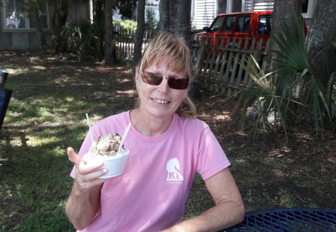 Ok, NOW I'm feeling better. 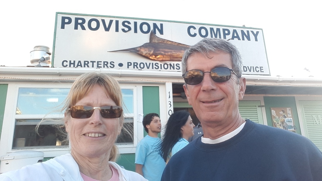 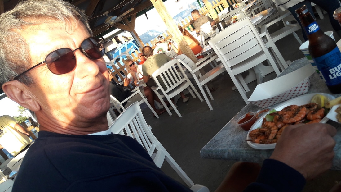 Shrimp, shrimp and more shrimp!
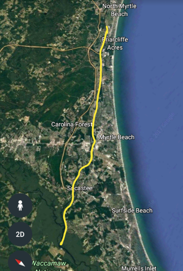 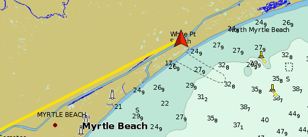 Blue Moon in Myrtle Beach It rained most of the night, but when we woke up, it was sunny. We couldn't check the weather forecast on the internet, but so far, it looked like it was going to be a beautiful day. So at 7:15, we pulled up the anchor. Next stop was Myrtle Beach. There were no anchorages in this area, so we needed to make arrangements to get a slip at a marina for the night. Once we were able to get phone service, I started calling marinas. There was another fishing tournament going on in the area and many of the marinas were full, but we did find manage to find a slip. We arrived at Barefoot Marina at 10:15 and visited the fuel dock before proceeding to her slip. The current was swift, but with a little help from the dock staff, Blue Moon was soon secure in her slip. The rate was $1.50/ft including electricity, even though we didn't need power and didn't bother to hook it up. After doing our boat chores of filling the water tank and tidying up, we headed out to explore. First we had some business to take care of. After the Dockmaster printed a form (off our thumb drive) for us, we headed to a bank to get it notarized. A nice lady at the bank provided that service and wouldn't take any payment. Then it was a short hike to the post office to mail it. With that out of the way, we walked to Barefoot Landing, which is a complex of over 200 shops and restaurants. After moseying around the shops, we went for a libation at The House Of Blues. We chatted with the bartenders for a while. Danielle was from Charlotte and is dating a musician and Gareth is from South Africa. It was his first day of work there. It was interesting talking to them and learning about their lives. We headed back to the marina before the weather turned nasty. At 5:30, it started to rain and the winds increased. We decided that we weren't going out in the rain. It was a good leftover soup day. Trip Log-Day 30: 19nm, 3 hours, 60 gal diesel Trip Total: 722nm, 113.50 hours, 184 gal diesel. 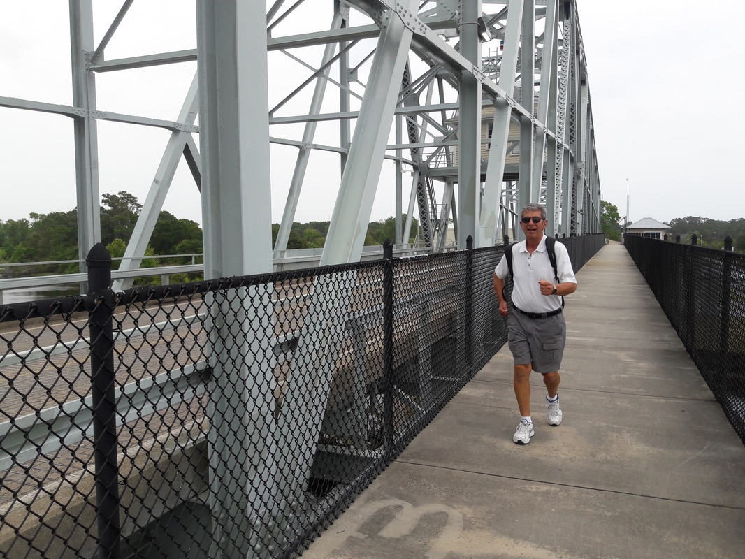 Run Forest Run! 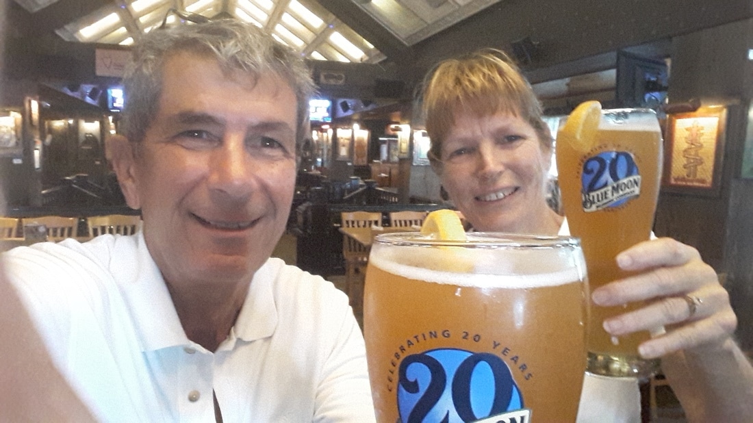 It says on the glasses that it's Blue Moon's 20th birthday. But it's actually 30 years for our Blue Moon. Left-Barefoot Landing complex Right-View from the swing bridge. Barefoot marina is on the right side.  Matt's version of the AT  Blue Moon at Barefoot Marina 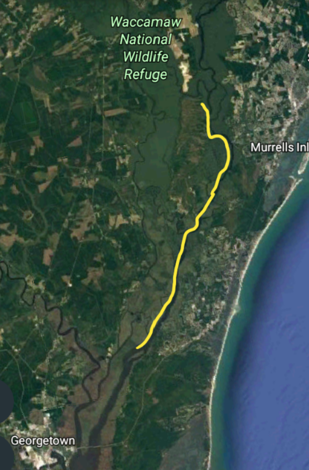 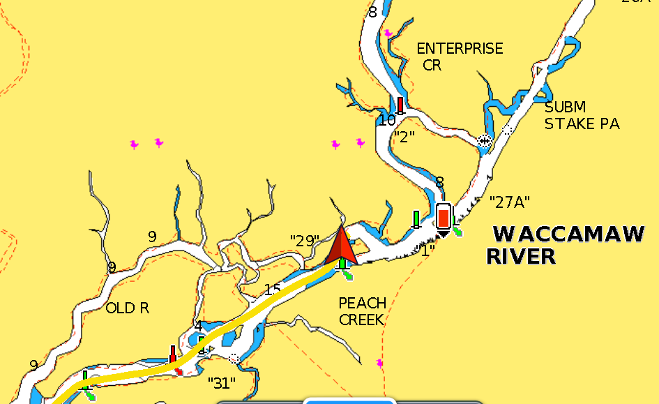 The anchor was up and we were on our way by 6:15. The rain wasn't suppose to begin until later in the morning. We thought that we could get a couple travel hours in before then. Today's portion of the ICW is one of my favorites. Cruising through Waccamaw National Wildlife Refuge is so pretty and peaceful. The waterway is lined with cypress, oak and pine trees. At 7:45, we arrived at today's destination, Cow House Creek. It wasn't raining and we were riding with the tide so we decided to go another 10 miles. At 9:15, we arrived at an oxbow on the Waccamaw River. We contemplated going another 20nm to Myrtle Beach (the next possible place to spend the night), but without the radar app, we're less brave to forge onward when thunderstorms and high winds are predicted. It is very frustrating not having an internet signal, especially when it comes to checking the weather. According to the last report that I received at 6:00, we could expect thunderstorms from noon until sunset. NOAA has issued small craft warning from 14:00 until late evening. Any way, it was such a pretty anchorage. We should stop and enjoy it. Because of our fear of fouling the anchor on one of the nearby trees in the water, we decided to use a trip line. We dropped the anchor but it didn't catch. On our second attempt, it immediately took hold. We were totally isolated... No phone, no internet, not a single luxury. During the day, it would look like it was going to rain but then the sun would come out. At 15:00, the rain did come and it was steady into the evening. We spent the day reading, napping, playing the uke and generally just entertaining ourselves sans the internet. Today was most definitely a soup day and Matt cooked up a batch of chicken soup for dinner. Trip Log-Day 29: 19nm, 2.75 hours Trip Total: 703nm, 110.50 hours, 124 gal diesel. Cruising through Wassacaw Refuge 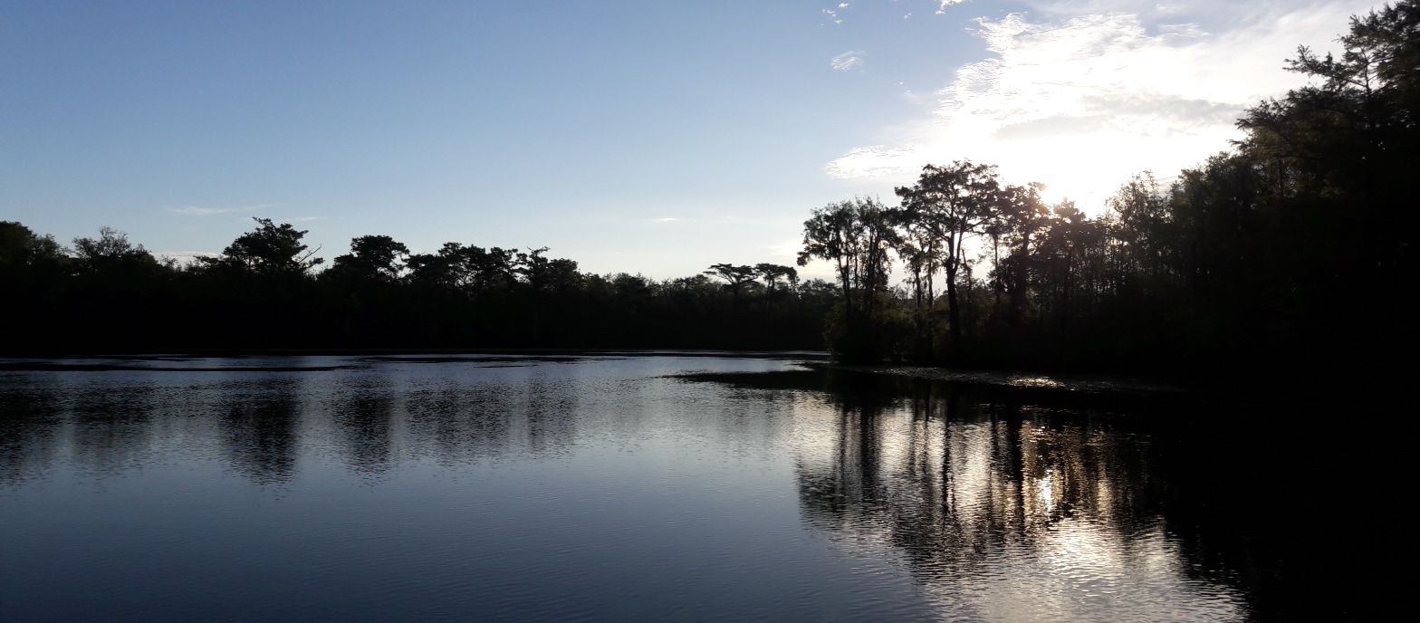 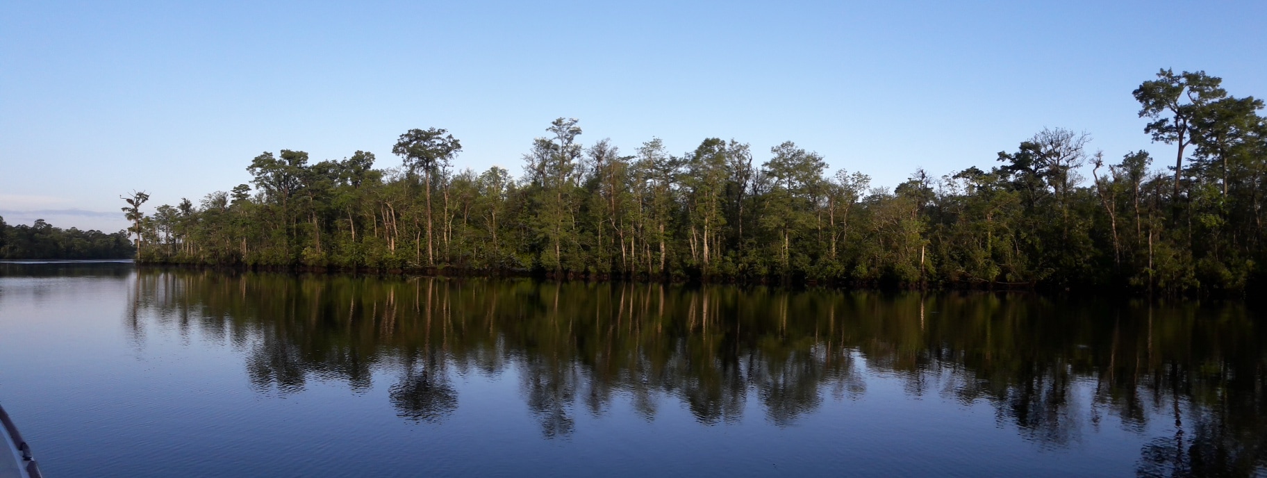 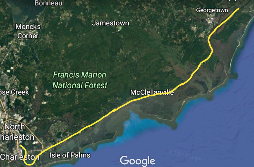 64nm  Today marks the end of week #4. Can't believe it's been a month. Seems like we just left on this adventure. Do we stay or do we go? That was the question last night. If we didn't leave the marina first thing in the morning, we'd be stuck in Charleston until Thursday due to rain and increased winds. So our plan was to leave the dock at slack tide (5:40am). Throughout the night, I got up and checked the weather app. The predicted 2:15am thunderstorms never materialized. But at 5:30, the wind did pick up and it began to rain. We got up and waited for it to stop. At 6:00, it was becoming light enough to see, the rain has stopped and the wind has decreased. It was a "go". I untied the lines, and Matt manuvuered Blue Moon away from the dock. As we pulled out of the marina, we saw one of the this weekend's visiting tall ships glide past us. In the early morning light, it was eerie. It felt like we'd stepped back in time to the days of pirate ships. Today we cruised through more of South Carolina's marshlands. Due to the extra low tides, we saw depths of less than 4 ft.(esp. in the stretch near McClellanville). I called a couple marinas in Georgetown to see if we could get a slip, but there was some big fishing tournament going on and all the slips were being used. At 13:30, we passed Minim Creek anchorage where we had originally intended to spend the night. But since we were now riding the tide and the sun was shining, we decided to keep going. At 15:40, we dropped anchor near Butler Island and opened a couple beers. It had been a restless night and then 9.5 hours of traveling. We both were tired. After the beer, Matt decided to fix a hole in the boat. For the last couple months, we have noticed some water in the bilge, and couldn't figure out where it was coming from. A couple days ago, we discovered it was seeping in around a wire that went thru the stern hull, right above the waterline, to the old depth sounder. So Matt got the underwater epoxy out and stopped the leak, at least until the boat is hauled and we can fix it right. After dinner, we had intermittent light rain, but we could near thunder nearby. We went to bed early. Trip Log-Day 28: 64nm, 9.5 hours Trip Total: 684nm, 107.75 hours, 124 gal diesel.   |