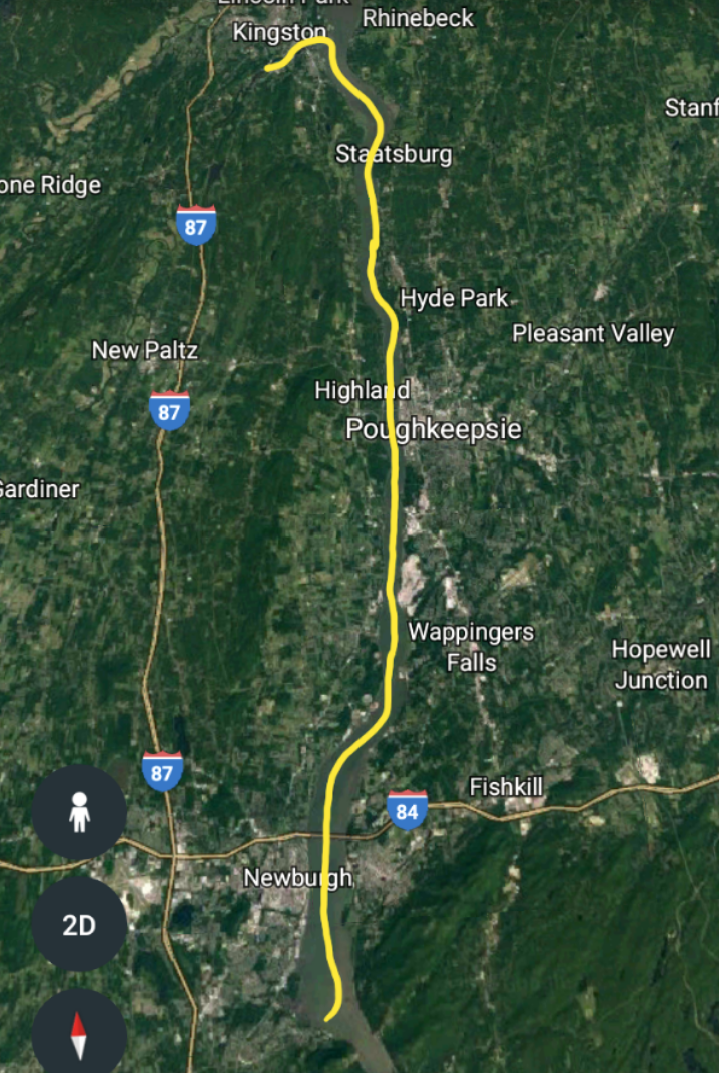
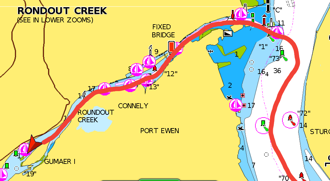
  Our first anchorage. 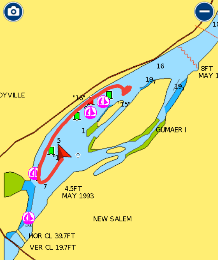 Our second deeper anchorage. At 5:05, I stumbled out of bed to use the head, glanced out the porthole and saw a gorgeous sunrise. I yelled to Matt that he needed to get up and look at this sunrise. Then I grabbed the phone and went outside to take some photos. Ten minutes later, I went back to bed and tried to warm up. It was cold outside. By 6:30, we were up and picking up the anchor. Cruising up the Hudson River has been a very pleasant experience. The area is not crowded with boaters, the scenery is very nice in addition to being interesting and the trains, constantly going up and down both sides of the river, are fun to watch. I spent a good part of today's trip on boat chores including defrosting the fridge and cleaning the head. We arrived at Rondout Creek, near Kingston, at 10:15. Our first task was to find a marina to pump out and get water. We usually just get these chores done when we buy fuel, but we didn't need any. We stopped at Rondout Marina, where a very nice woman caught our lines. We pumped out ($5) then, after asking permission, we filled our water tank and water jugs and bought ice. We traveled further up the Creek until we found a suitable place to anchor near Gumaer Island. It was high tide (+4ft) when we dropped anchor in 8 ft of water. We hoped that when the tide went down and we swung around, that were not sitting on the bottom. We dinghied 1.7nm down Rondout Creek to Kingston's waterfront and went to the City Marina. We asked if we could leave our dinghy and check out the town. He said "sure, that will be $10 for the dinghy dock". I asked him if there was somewhere that we could put the dinghy for a couple hours that cost less than $10. He directed us to the Ole Savannah Restaurant. He said that they had no problem with people using their dock. So we tied up there and bought a beer. We then did a walk-about through the small waterfront section of the town. The more modern part of Kingston was 3-4 miles away, but there was no way to get there. The trolley only operated on the weekends and there was no Uber here. As we were walking, a strong garlic aroma was coming from a nearby restaurant and it was drawing us closer. I became hungry but it was was only 15:15. The restaurant was called Savona's Trotteria. We checked the menu and decided to have an early dinner (they were still calling it lunch time). We ordered the "Express Lunch" and chose lasagne for our main courses. It also came with a salad, delicious garlic bread sticks, cannoli or cheesecake and coffee. It was a delicious meal. When we were leaving, we saw that Billy Joel had eaten there with his daughter and had given it a 5 star rating. After dinner, we took a walk along the waterfront. The history of the area was explained on plaques placed along the walkway. We dinghied back the 1.7nm to Blue Moon and were relieved when we saw her where we left her. When we got closer, we noticed that she was listing to port, than we saw that the she was very close to shore. The tide had gone down, and she had swung onto a shoal. She was hard aground. We boarded her and waited. We needed about a foot of water to be floating again. It was low tide and the water would soon be rising. At 19:20, Blue Moon was floating. We put the dinghy on the davits and picked up the anchor. Then Matt slowly piloted Blue Moon to deeper water. We moved .5nm further down the Creek and anchored in 6 ft of water at low tide. Hopefully, we won't wake up on shore tomorrow morning. Trip Log-Day 58: 32nm, 4.75 hours, Trip Total: 1591 nm, 246 hours, 379 gal diesel. 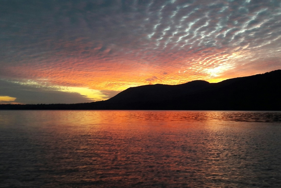 This was one of the first things that I saw when I awoke this morning. 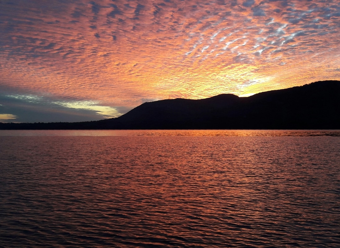 And the sunrise continues. 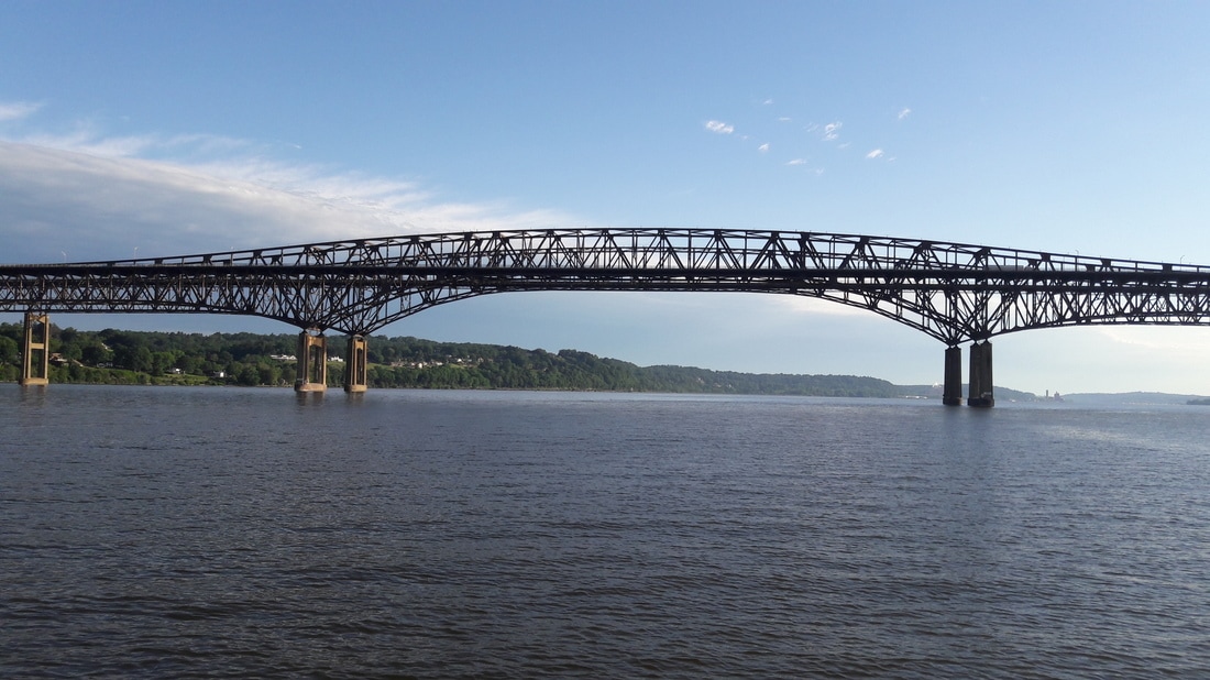 The Newburgh bridge 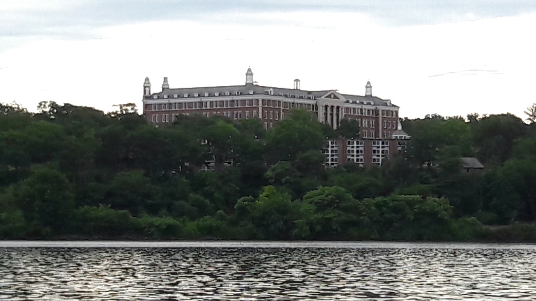 The Culinary Institute of America near Hyde Park. 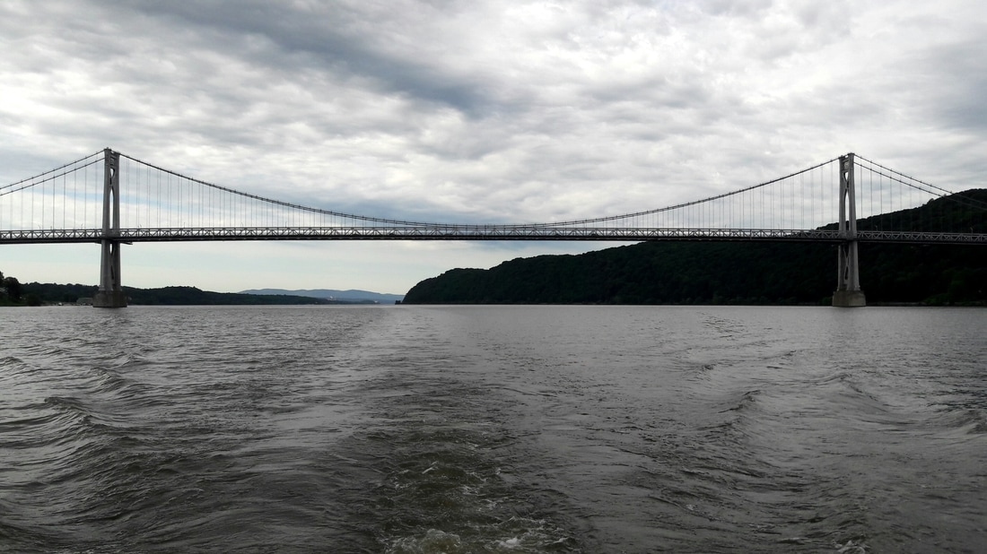 Mid-Hudson bridge Mid-Hudson Railway bridge and one of many, many, many trains going along the river. 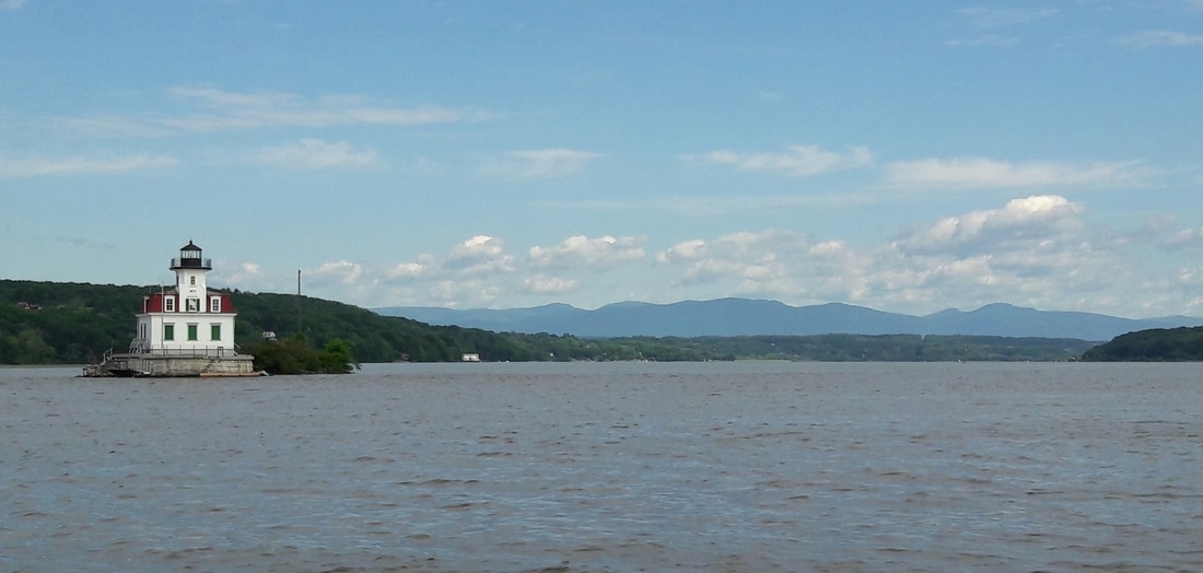 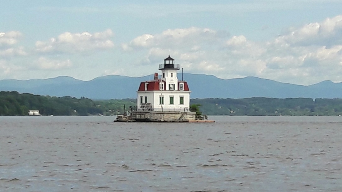 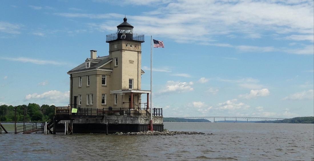 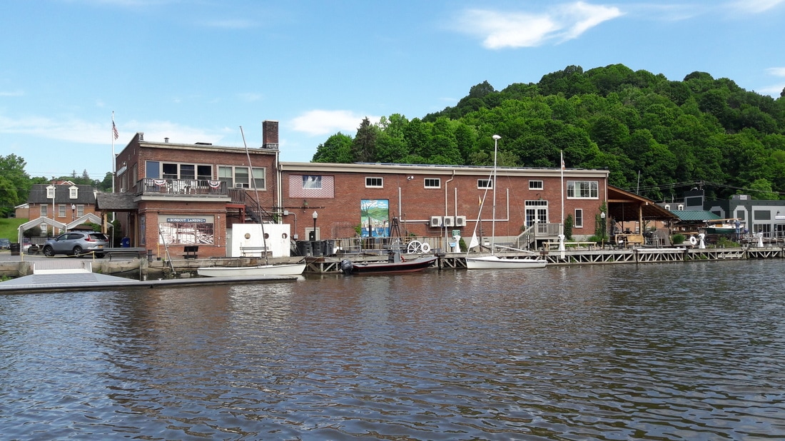 The Maritime Museum Scenes on Rondout Creek 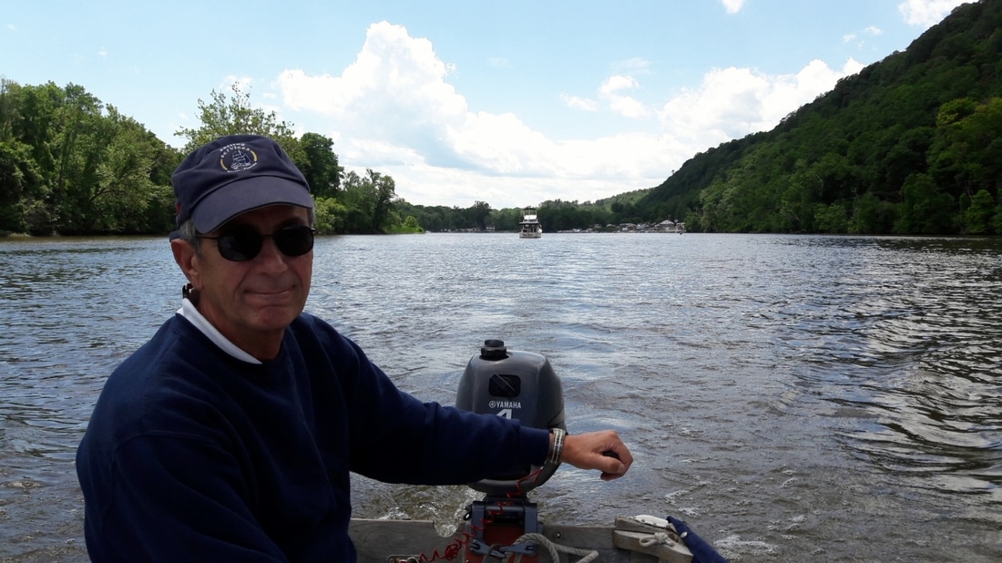 Leaving Blue Moon and going to Kingston. Photos of Kingston's waterfront. 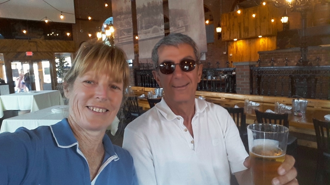 At Ole Savannah's, having a beer after tying up to their dock. 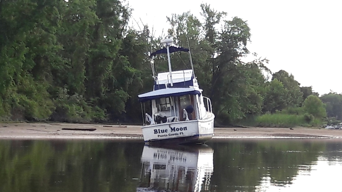 Uh Oh. Not something that you want to see when you get back to your boat. At least we won't be rocked by any passing boats.
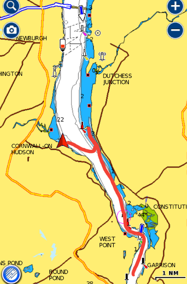
0 Comments
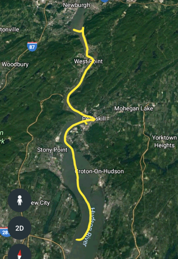  We rocked most of the night. We were able to sleep but it wasn't uninterrupted. When a larger wave slapped the boat or when the mooring ball banged on the hull, we would be jolted out of our sleep. We are slowly learning the ways of the river. We need to find anchorages that are out of the current so that Blue Moon is facing into the wind instead of going with the current and not have the waves hitting the side or stern of the boat. We decided to leave as soon as we got up. We were both tired of the constant rocking. At 7:00, we freed ourselves from the mooring ball and headed north. There were a couple possible anchorages for us to choose from. We arrived at the first, Lent's Cove, which was very protected and pretty, but Blue Moon was kicking up mud as we entered. It was too shallow even for her. Then we went around the corner to Peekskill and dropped the anchor. It was about 10:00 and it was very comfortable. Then the tide changed direction and the winds increased to 15mph and we were once again rocking. We had planned to dinghy to shore a little later, but we knew that wasn't going to happen. It would be a wet ride. So at 11:00, we decided to find a better place for the night. We picked up the anchor and headed another 11nm to Pollepel Island, where the ruins of the Bannerman Castle are. But this place really didn't give us much protection either, plus there were rocky shores all around us. We are finding that determining the actually wind direction of this river can be tricky. The wind appears to be coming from one direction, when it actually is coming from a different direction and bring deflected by the mountains. Also, the winds will funnel between the mountains making the winds appear to be a lot stronger than they are. We were still looking for an anchorage and we found a possibility. It was on the opposite side of the river in a cove. We dropped the anchor in 6ft of water. I did attach a trip line, as the charts indicated that it had a rocky and grassy bottom. This was a good anchorage. The current wasn't very strong and we were protected from the wind. The only problem was that we were anchored right next to freight train tracks (the passenger trains were on the other side of the river). A train goes by every half hour, and it's whistle blows as it go through Cornwall. Matt and I agreed that we'd rather have train noise over a rocking boat. After happy hour, we had our left over Sicilian pizza and salad for dinner. Then it was movie time. "Master and Commander" was tonight's choice. Trip Log-Day 57: 27nm, 4.75 hours, Trip Total: 1559 nm, 241.25 hours, 379 gal diesel. 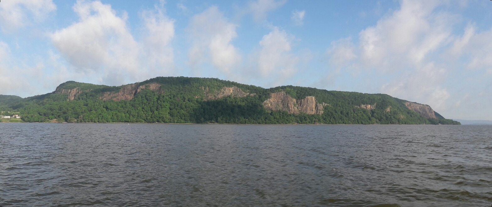 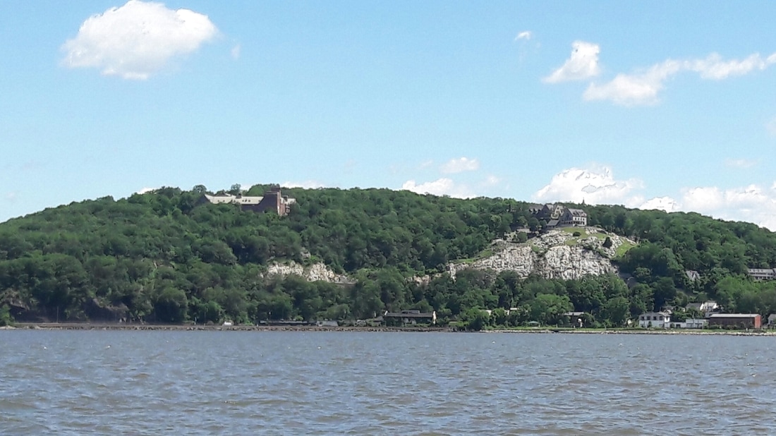 At Peekskill 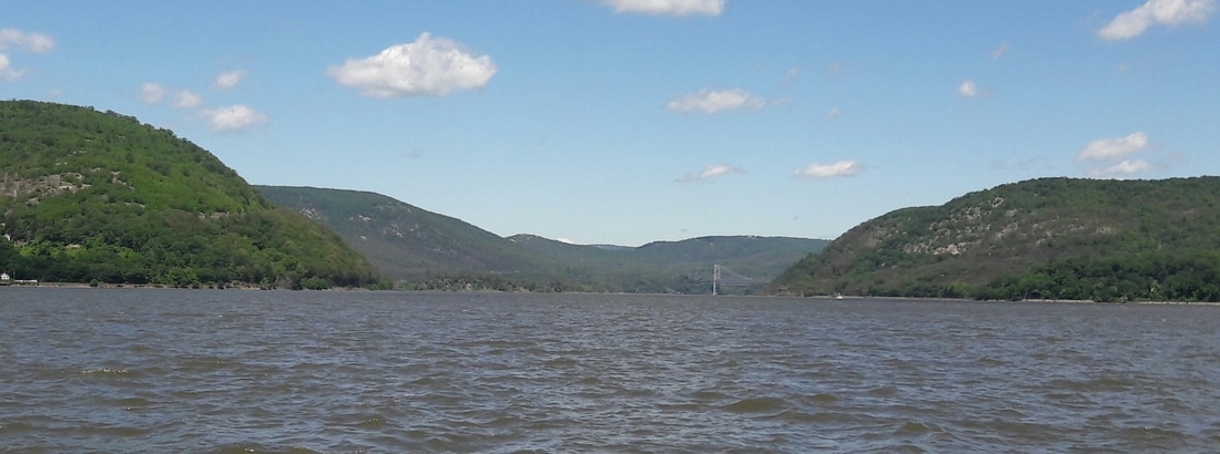 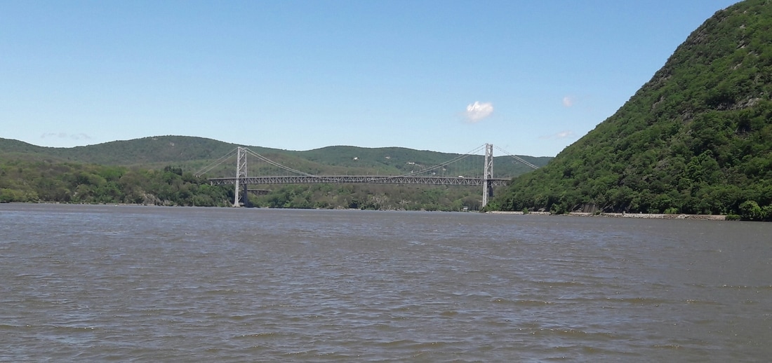 Bear Mountain Bridge 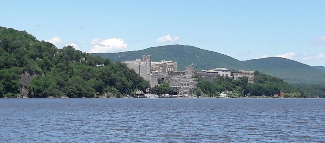 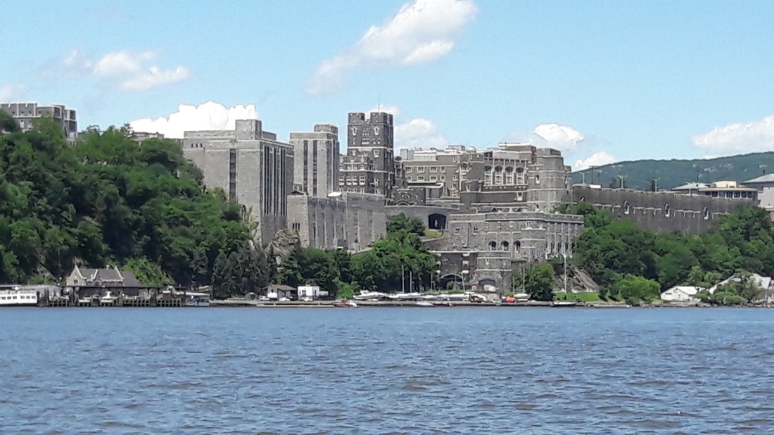 West Point 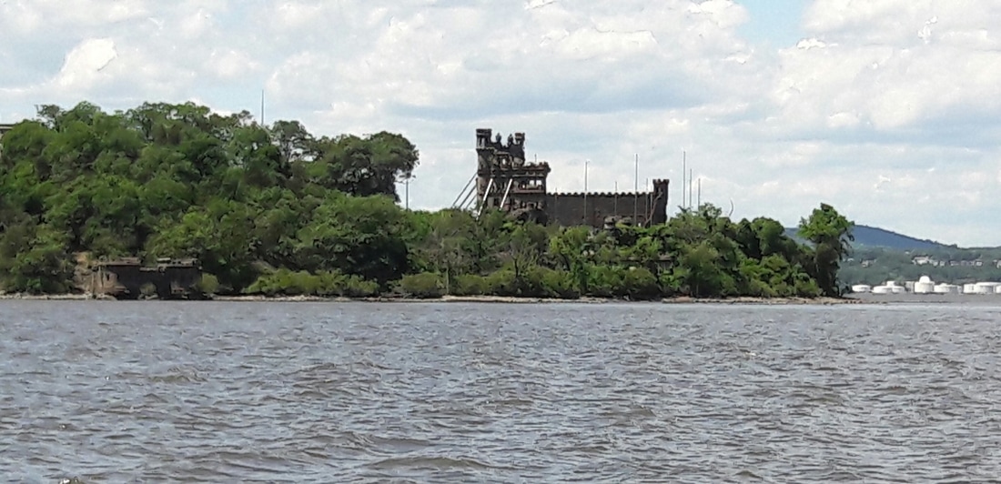 The ruins of Bannerman Castle 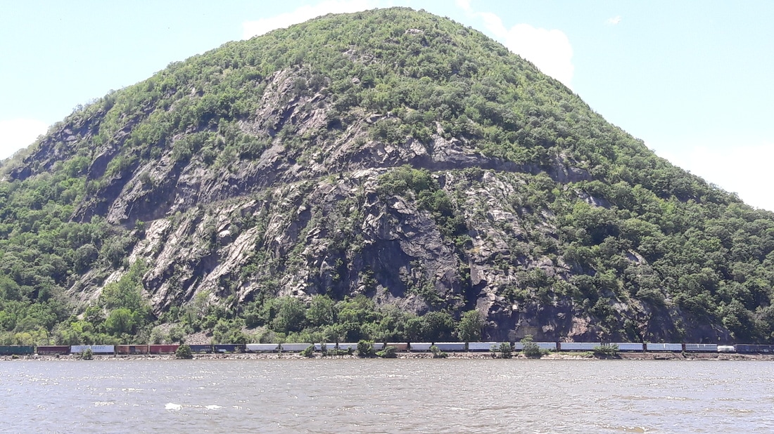 A road cut into the mountain and a train going by. 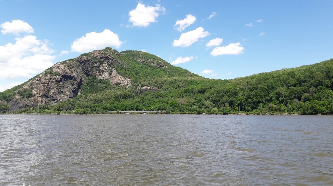 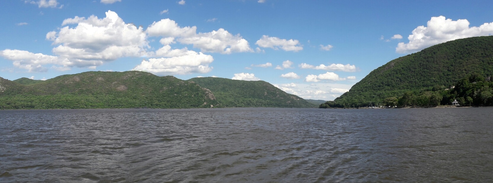 Tonight's backyard view. 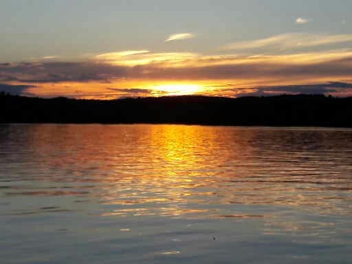 Tonight's sunset 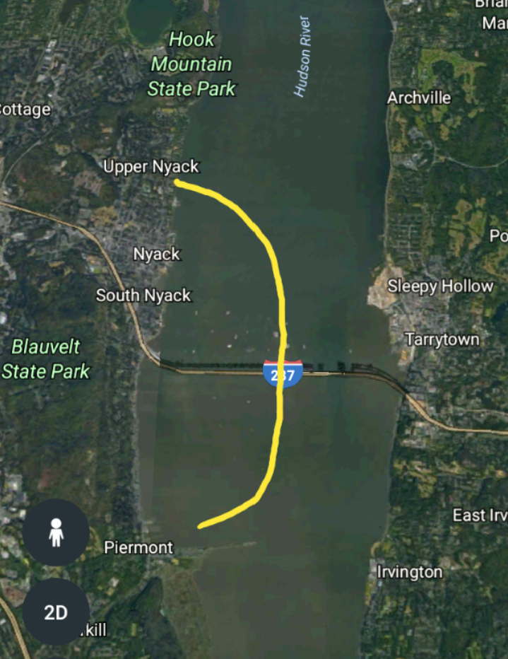 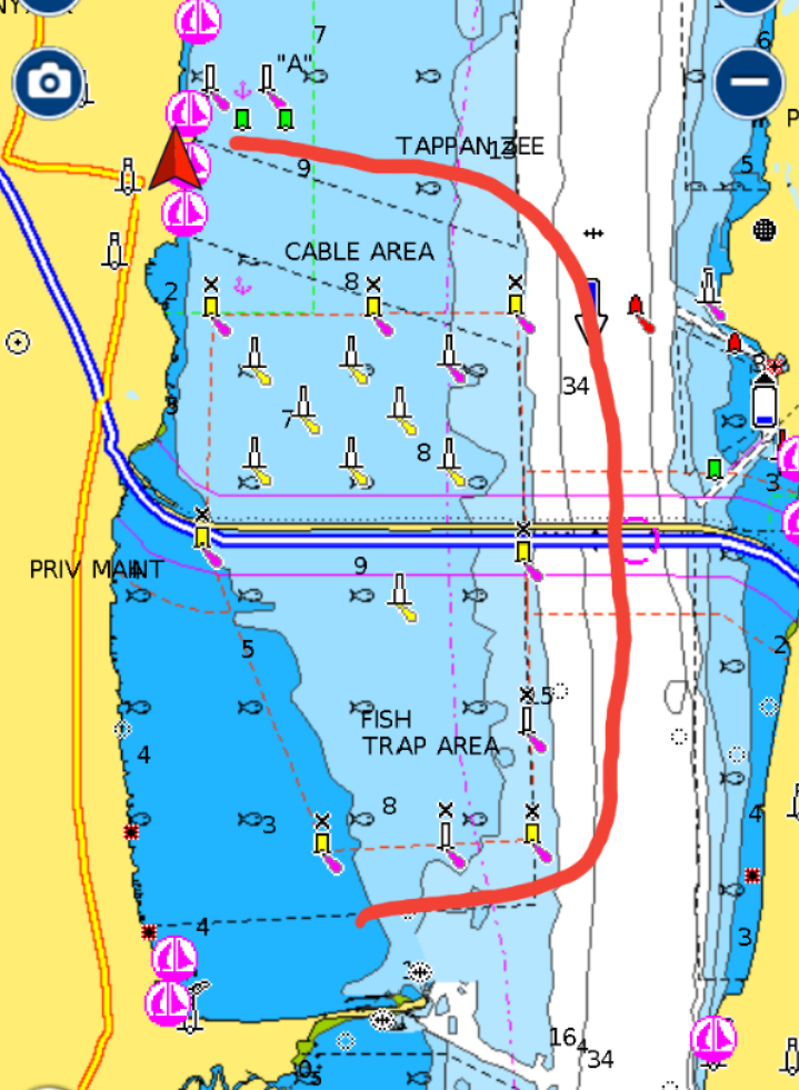 When we woke up at 6:00, the sun was shining but the weather forecast was for 2 inches of rain later in the day. We had breakfast, picked up the anchor and started our trip to Nyack. We attempted to contact the Nyack Boat Club by VHS radio but no one answered. So we did as their web site said. We picked up one of their 5 guest balls. The launch tender would be around later in the day to collect their $25. We gathered our laundry and dinghied to the Boat Club's dock. The building was unlocked and the upstairs doors were wide open, but there was no one there. We signed the guest book as the web site directed and looked around the facility. It was a nice boat club built in an old house overlooking the river. We then set out in search of a laundromat. We carried our 10 days of laundry 1/2 mile uphill to the laundromat. With our clothes clean and folded, we headed down hill back to the boat club. The winds had increased since we left Blue Moon and our ride back was a wet one. I was able to shield the clean dry clothes from the salt water, but Matt got soaked. Back on Blue Moon, it was rocking. The wind and current coming from opposite directions, caused her to lie with her beam to the waves, which made it very uncomfortable inside. Also, while we were at the laundromat, we heard on the TV that there was a chance of tornados later today. We decided to abandon ship, at least for the the afternoon. We would wait it out on shore, returning tonight when the worst part of the storm has passed. It was noon and the line of rain, thunderstorms and wind was suppose to last until early evening. We gathered up our shower supplies, a change of clothes, and our Kindles then dinghied back to shore. We sat on the Boat Club's veranda for a couple hours reading, watching the clouds come in, and chatting with some of the members. We walked to a nearby bar for Happy hour as the rain began to pour. After a drink there, we went in search of an authentic NY Italian pizza experience and came upon Taratelli's. It felt like we walked into a movie or maybe the Sopranos. The people watching was great and the Sicilian pizza was delicious. We returned to the boat club. It was now only sprinkling and the wind was calm. After checking the weather radar and seeing that the red and orange areas had passed, we decided to return to Blue Moon. As Matt bailed the dinghy, the rain fell harder. We had our rain gear on, so as long as it remained relatively calm and there was no lightening, we would dinghy back to the boat. Later in the evening, we were treated to a double rainbow and a sunset. Trip Log-Day 56: 3 nm, .50 hours, Trip Total: 1532 nm, 236.50 hours, 379 gal diesel. 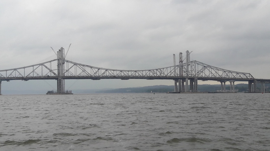 The old Tappen Zee bridge The building of the new bridge. We heard from a local sailor at the Boat Club that the state was spending millions of dollars each year to repair the old bridge and that the building of the new bridge has brought many jobs to the area.They haven't officially decided on a name for it, but he said the Mario Cuomo bridge was a strong possibilty. 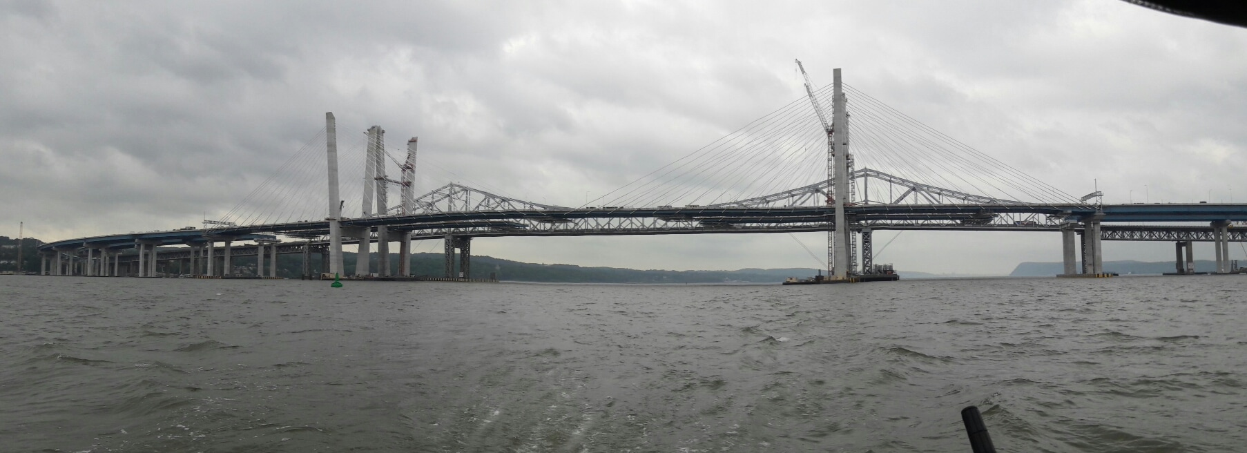 The new bridge 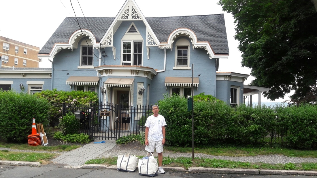 The Nyack Boat Club building. We're off to find a laundromat. 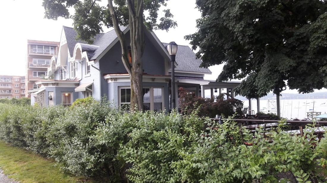 The Nyack Boat Club building. They have a nice facility here. 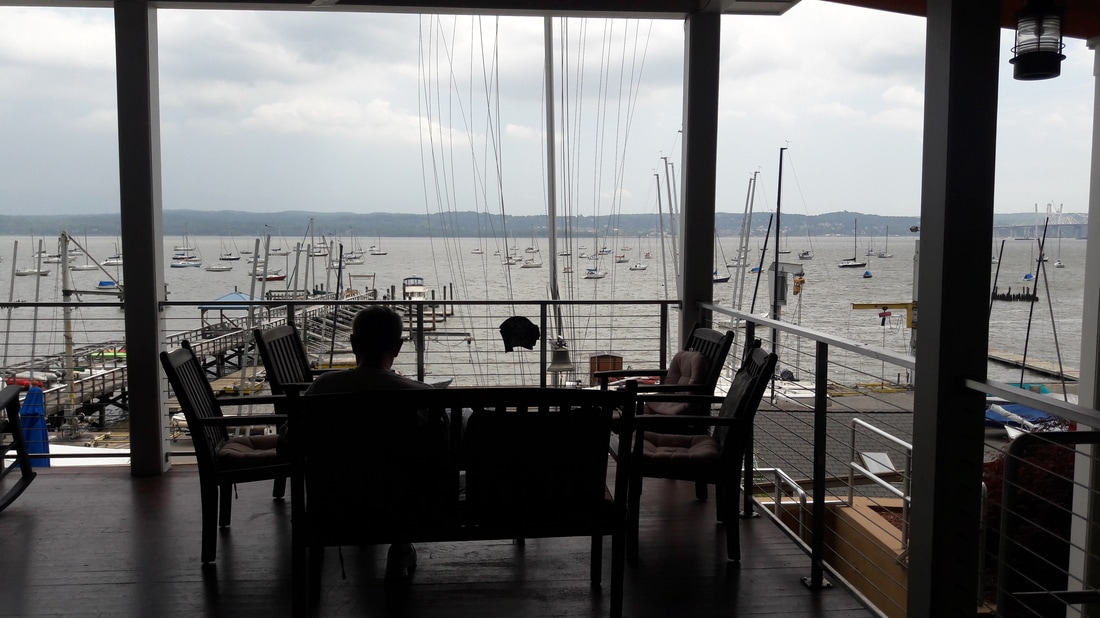 Matt sitting on the veranda waiting for the storm.  Happy hour 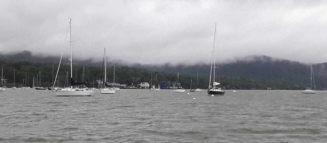 The mooring field during the rain 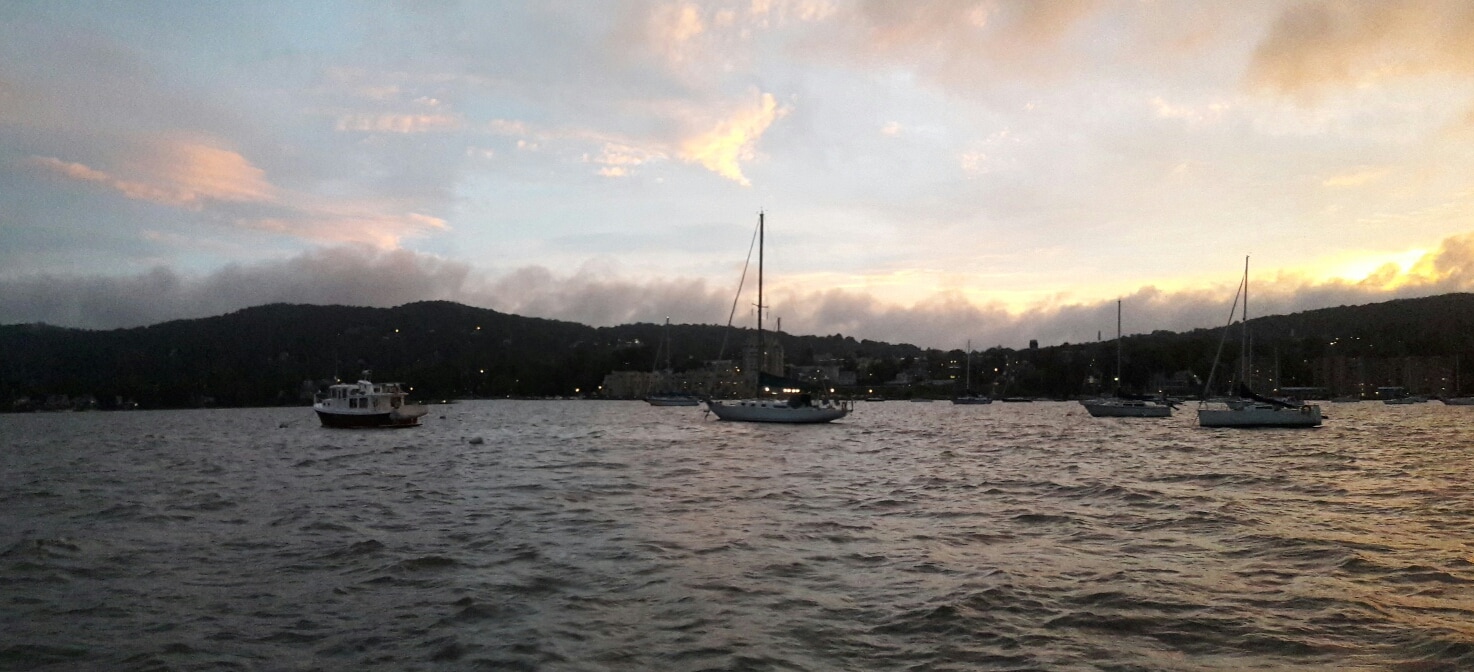 Then there was blue skies and sunshine again. 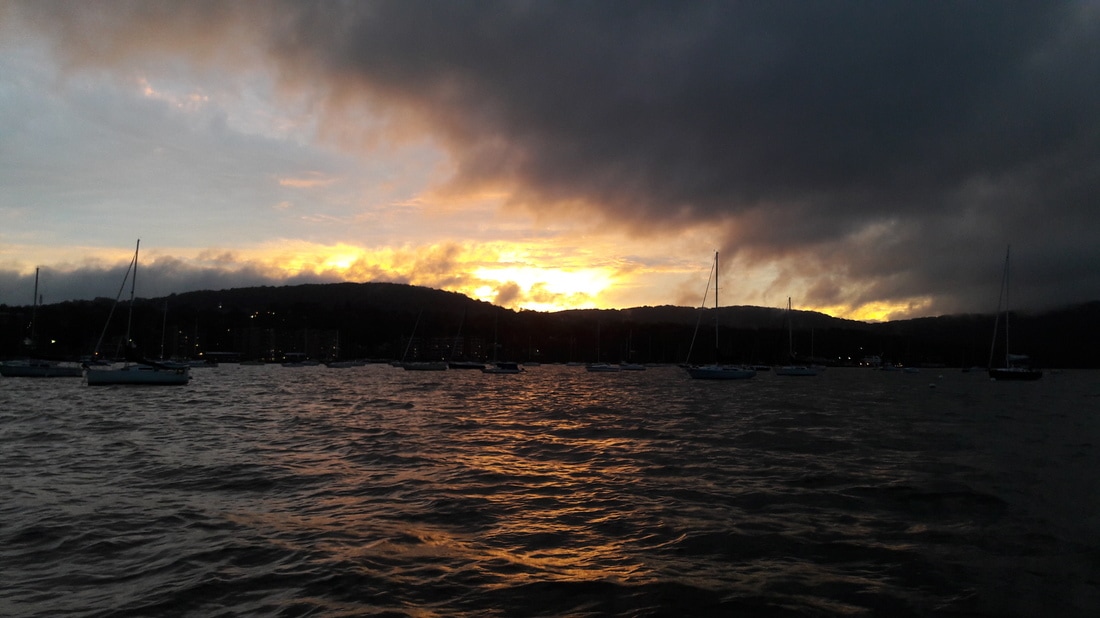 The sunset after the storm.  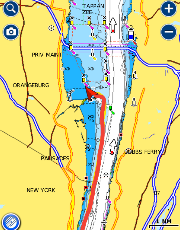 Last night the fog returned. Even though we were anchored only 300 yards from Lady Liberty, at 22:30 she completely disappeared. Her light no longer shown through the fog. Throughout the night, fog horns could be heard in the darkness. It was very eerie. Coincidently, Matt was reading a book about the collision in the fog between the Andria Doria and Stockholm. We had planned to get up early and catch the incoming tide up the river, but when we awoke at 5:00, we were fogged in. So we went back to bed. We weren't going to do another fog filled day. We got up at 7:00, and it was still foggy. We had breakfast and by 8:00, it began to clear. But now the tide was ebbing with a 1.5kt current and would soon be 2.2 kts. We decided to hang out and leave at 12:30. At that time, the tidal current would be flowing up the river again. In addition, this gave us more time to enjoy our NYC view. Matt and I both have learned several things about this area, that we didn't know. One thing is that Lady Liberty (and Ellis Island) reside in NJ and we were actually anchored in NJ last night. It is called New York Harbor, but half the harbor and half the Hudson is in NY and half is in NJ. We spent the morning reading, planning out next couple days, playing the uke and tidying up the boat. As the fog cleared, the sun came out, and so did all the boaters. Blue Moon was getting continuously waked. So at 11:30, we decided that we would rather fight the current than deal with all the rocking from the wakes. We pulled up anchor, bid farewell to Lady Liberty and started our journey up the Hudson River. The river was very busy and we were fighting the current, but we were still enjoying ourselves as we took in all the sights. As Matt dodged ferries, barges, pleasure boats, and tour boats, I was busy taking photos and, with the help of Google maps, pointing out various buildings and sites along the way. Soon we were passing under the George Washington Bridge and leaving the congestion behind us. This is where the "vacation" portion of this trip begins. The hard part is behind us (we think). We plan to slow the pace down and play a lot more. We dropped our anchor just south of the Tappen Zee bridge which is being replaced with a modern bridge. I have many memories of traveling across that bridge. Traveling west on it always meant "we're going on vacation" and traveling east meant "we're almost home". Tomorrow, we expect rain and increased wind. Our plan is to go 3 miles north to the town of Nyack and wait for the front to pass. Trip Log-Day 55: 25nm, 4.25 hours, Trip Total: 1529 nm, 236 hours, 379 gal diesel. 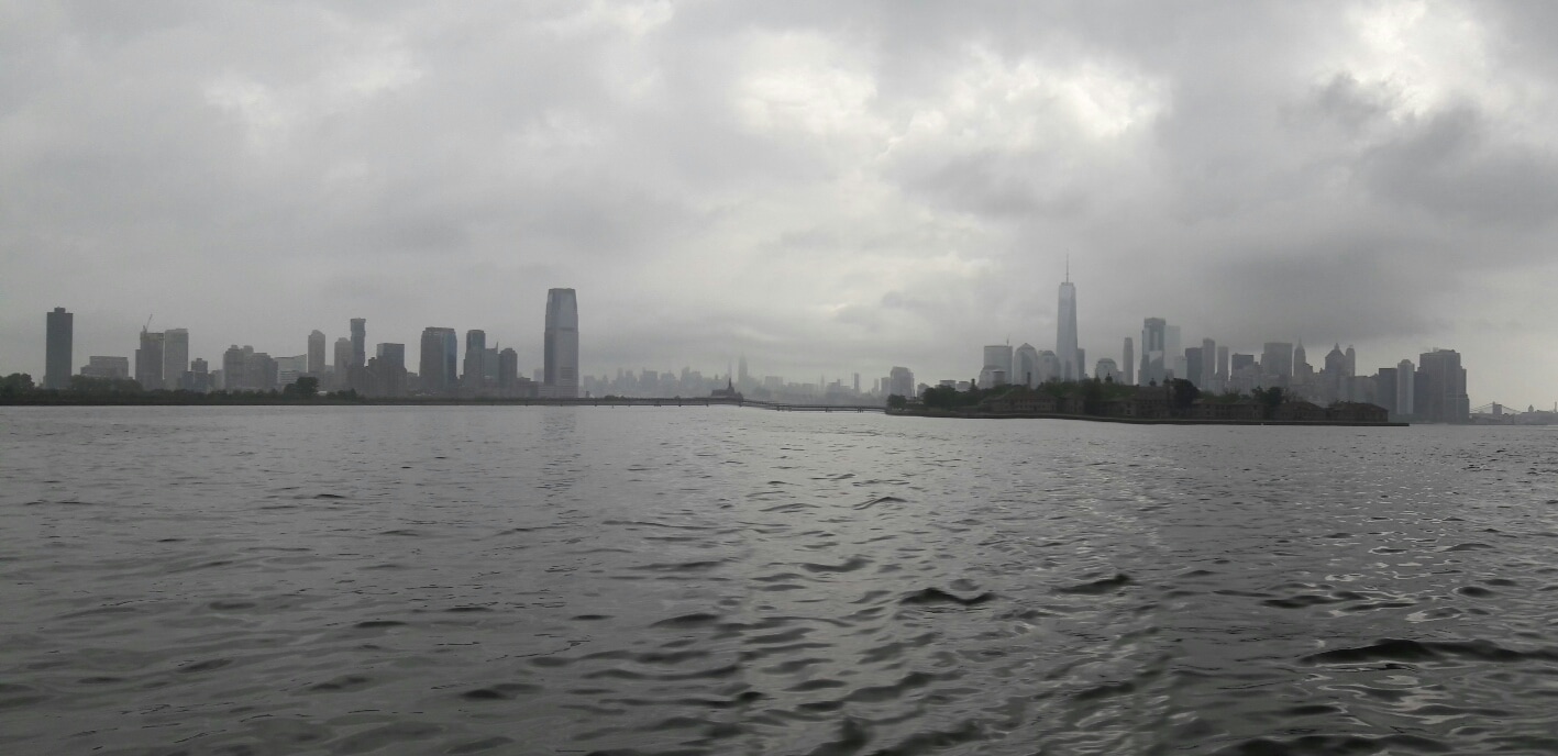 The morning fog on the Hudson Harbor has lifted. 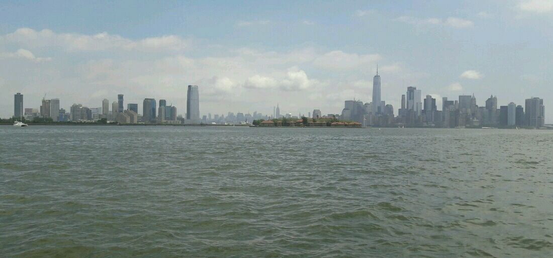 The sun does shine in New York City 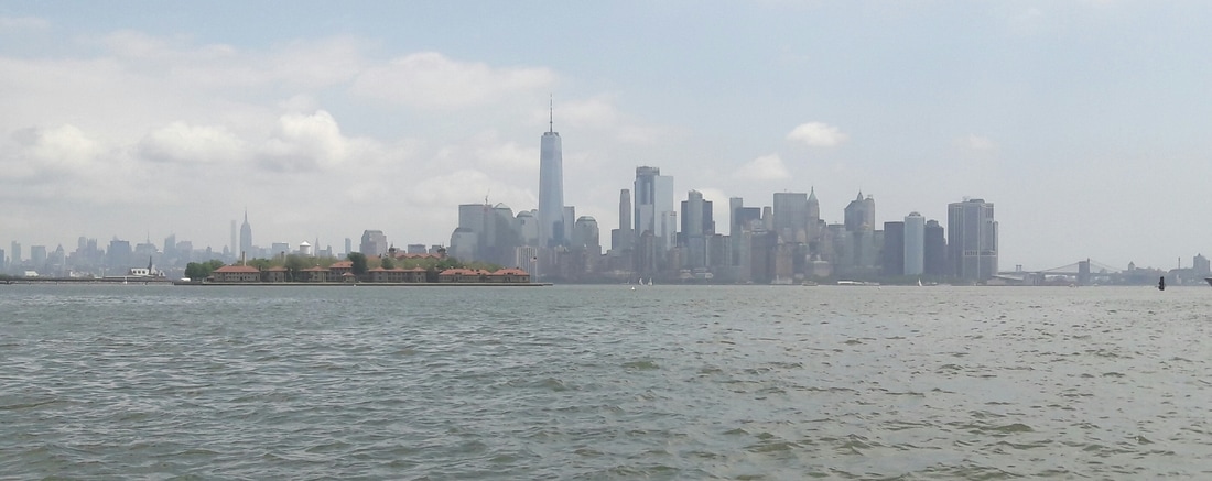     The front of Ellis Island    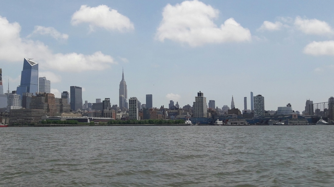 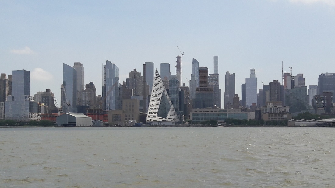 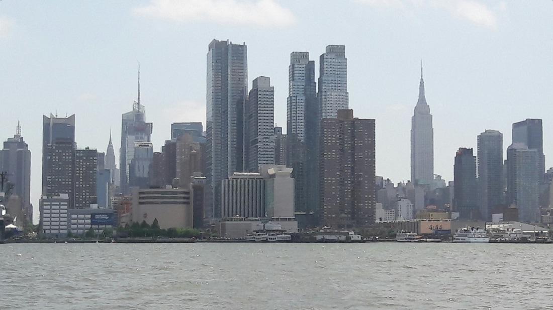 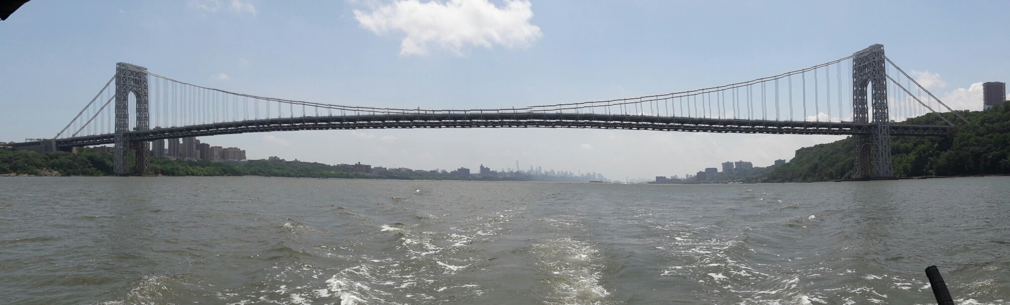 The George Washington Bridge- leaving NYC Today's view from the back porch 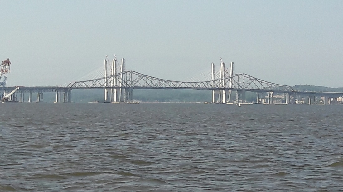 The old Tapanzee Bridge being replaced by a newer model. 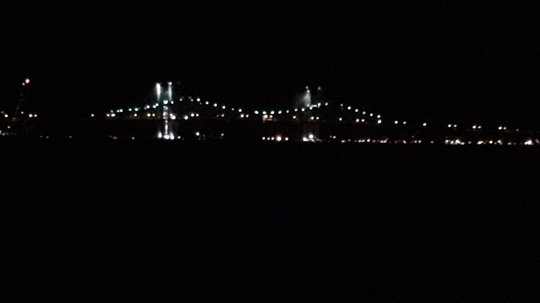 The Tappen Zee bridge at night    After we changed our anchorage. At 5:00, I checked the weather forecast which said 20% chance of rain and light SE winds all day from Manasquan to NYC...perfect. By 5:30, we had the anchor up and were riding the tide the 2nm to the inlet. The inlet had a rock jetty on each side and we would have to pass through it to get to the ocean. As we approached the inlet, we could see that the ocean swells were crashing into the opposing current creating, within the inlet, very large waves with steep peaks. At the same time, two sport fishing boats, who apparently didn't think that we were going fast enough, decided to pass us on both sides. This created large wakes and added to the confused wave action. Once we were outside the inlet, the wind was only 0-3kts, but the swells were 4-5 ft with many over 6 ft. The wave period was about 8 seconds, so there wasn't any pounding. It was more like a gentle up and down motion combined with a slow rocking. We also had fog and it became increasingly dense.We both had to watch for boats coming out of the fog. It was not a relaxing trip, instead it was very stressful having to constantly be on the lookout for other boats. As we were passing Sandy Hook, NJ, we started to see the outline of the shore through the fog. That was good because neither one of us wanted to enter the New York Harbor with poor visibility. At 10:30, we were approaching the Verrazano Bridge and the Narrows. We had anticipated a rough ride through the Narrows due to the opposing current and waves, but Brooklyn blocked the ocean swells and our ride under the bridge through the Narrows was easy. It was still hazy as we made our way through the inner harbor. We could see the outline of Manhatten as we got closer. As we approached the Statue of Liberty, we noticed very dark clouds to the west... yes, we were going to get wet. With a SE wind beginning to blow, we decided to anchor in the more protected Liberty State Park. As we entered the anchorage channel, it began rain. If we had arrived just 8 minutes earlier, we would have been anchored when it arrived. I donned my raingear and we prepared to anchor. Of course, the anchor didn't hold on the first attempt. We had heard reports that it was hard to get an anchor to set here, so we weren't surprised that we dragged when Matt tugged on it. As we were re-anchoring, it began to pour. We decided to wait until the rain stopped before we tugged on it. We wanted to give the anchor some time to work it's way down further into the mud. We spent the afternoon reading and napping. At 3:30, the rain stopped and the sun was peaking through the clouds. Matt woke up from his nap and we debated moving to a different anchorage. There was nothing bad about our present location, but we were on the Hudson River in NYC and we couldn't see anything from where we were. Plus, we remembered that Janis & Ralph had told us that we "HAD to anchor near the Statue of Liberty". So we picked up the anchor and moved around the corner. The view from this anchorage was awesome, but the wakes from all the river traffic was causing a lot of bouncing. Plus the current had us turned so that the waves were hitting on our beam, causing Blue Moon the rock from side to side. After happy hour, we had left over soup and a sandwich for dinner. When the boat rocked from a wake, we had to hold everything on the table or it would have ended up on the floor. Eating the soup was almost comical as the boat pitched from side to side. Matt decided to try to remedy the rocking by using his "surge proventer" technique. We hadn't had to use it since we had taken Gettinair to the Abacos in the Bahamas. It has been more than 10 years ago, but between the two of us, we remembered how to rig the lines so that it turned the bow of the boat toward the waves. This stopped the side to side rocking motion. Later, we sat on our back porch and enjoyed the night's special view. Trip Log-Day 54: 42nm, 6.5 hours, Trip Total: 1504 nm, 231.75 hours, 379 gal diesel.  The Verrazano bridge.   The Staten Island ferry.  Manhattan in the fog     Thinking of what my grandparents were feeling when they first saw the Statue of Liberty 100 years ago.   Ellis Island with Manhattan behind.  Tonight's backyard   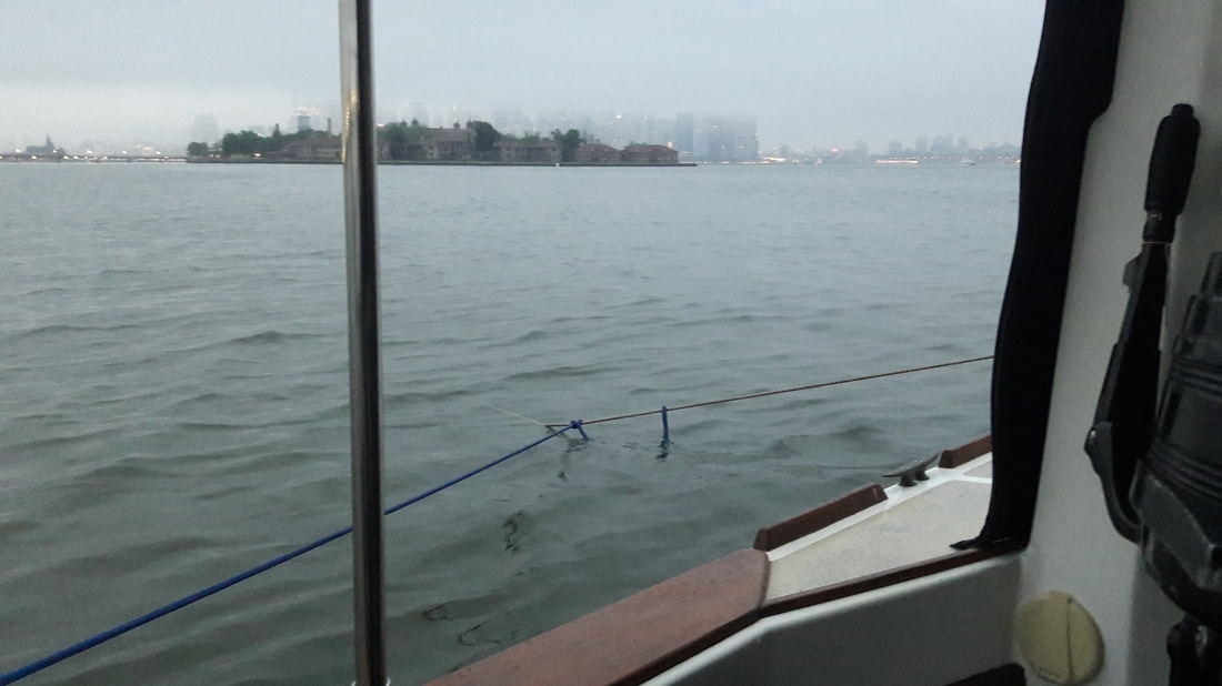 Matt's "surge preventer".-It turns the bow into the waves (wakes) when the boat wants to turn with the current. Prevents sideways rocking at anchor.   When we awoke this morning, it was cloudy, gray and a storm cell was passing close to us. So we waited awhile before we got on our way. We had breakfast and then picked up the anchor at 8:00. It was a hazy morning as we continued on our way through New Jersey. A nice cup of hot chocolate was a perfect addition to the dreary day. This morning, we received a "Waterway Guide Nav Alert" email reporting that the Coast Guard has issued warnings for 15 different areas on the New Jersey ICW where there are reports of shoaling. Maybe Blue Moon does deserve to be called "Shoal Survivor". We arrived at Manasquan at 11:00 and found a place behind Osborne Island to drop our anchor. The charts indicated depths of 1ft, but Active Captain noted that a boat drawing 3ft should be able to anchor here. It was 2 ft above MLW and rising. This was the closest anchorage to the inlet that offered any protection and it was in a "no wake" zone. If it was too shallow for Blue Moon, we'd explore the other options. We crept toward the island keeping an eye on our depths and seeing nothing under 7 ft (which meant 5ft at MLW). Once we were far enough off the channel, we dropped the hook. The afternoon was spent reading, researching anchorages on the Hudson, playing Words with Friends, drinking beer and being lazy. It was another Soup Day, so Matt cooked up some chicken soup for dinner. That heated up the cabin nicely. This is our last day in New Jersey, if the weather forecast doesn't change, we plan to be heading to New York City tomorrow morning at first light. Trip Log-Day 53: 18nm, 3 hours, Trip Total: 1462 nm, 225.25 hours, 379 gal diesel. 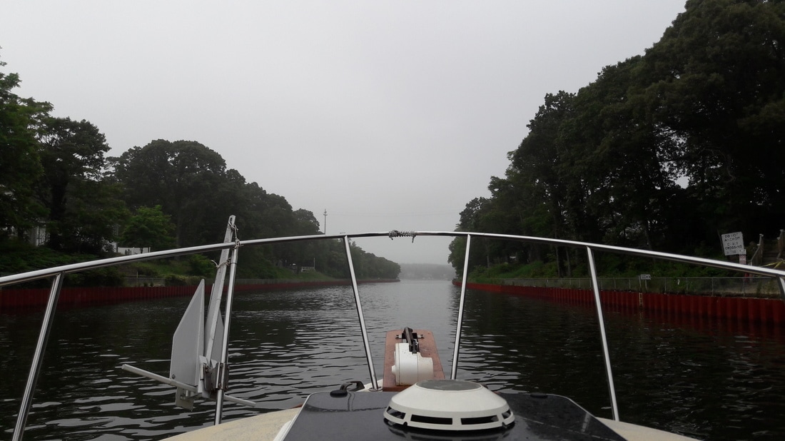 The Point Pleasant Canal 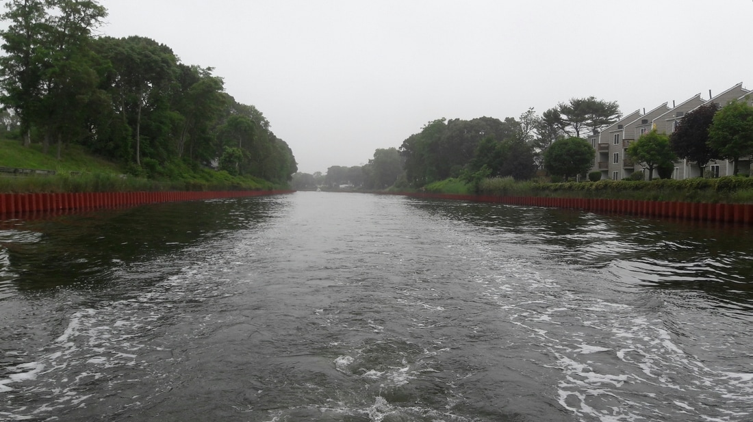 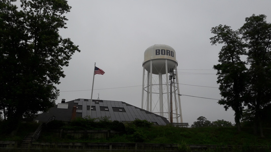  Osborne Island-where we anchored. 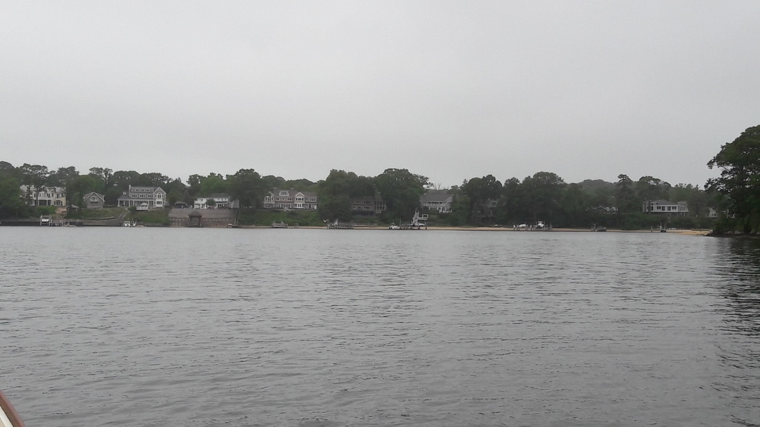 Tonight's backyard view on the gray day. No sunrise or sunset today.  This morning, we received this Waterway Guide Nav Alert issued by the Coast Guard. It lists 15 different areas of shoaling along the New Jersey ICW. I knew we weren't imagining it.   It was another pleasant night on the boat although a little cool. We awoke at 6:00 and immediately checked the weather forecast. Yesterday, we had chatted with the crew of a neighboring boat who were in the process of doing the Great Loop. They were also waiting for a weather window so they could to proceed to NYC and were thinking that Saturday was the day. So when we checked the weather this morning, we took a close look at Saturday. So far it was looking doable, but that could change with the next weather forecast. We were 70 miles from Manasquan, the jumping off point. If we went further than we had planned today, we would be ready to go Saturday morning. That is, if the weather forecast remained good. We entered today's route in the chart plotter, picked up the anchor and were on our way by 6:30. It was low tide and would be rising in a short time. An hour later, we were going through Grassy Bay, which on the chart appears to be a narrow channel winding through a 1 mile wide grassy area. In reality, it is a very shallow body of water with a poorly marked channel. The water depth in the channel was 4 ft much of the time and at on point, the channel went right over a shoal with breaking wavelets. We did hit bottom there, but Matt was able to easily back Blue Moon off the shoal. We then found some deeper water and creeped through the area. Then we came to a place where, according to the chart, there was a wide path of 20+ ft of water. The channel markers didn't take us through the 20ft water, instead they lead us into a very shallow area as indicated in the chart. We decided to follow official markers and the water depth dropped to 3.2ft. We again crept along and soon were a back in 9ft depths. I've read that the channel markers are removed by NJ officials for the winter and replaced in spring. Maybe that's why they don't always seem to be in the proper spot. After this trip on New Jersey's ICW, Matt wants to change Blue Moon's name to "Shoal Survivor". At 9:30, we pulled up to Beach Haven Yacht Club Marina dock to get fuel. This Marina is one of the most hospitable marinas that we have encountered in all our travels. After the friendly dock hand caught our lines and tied us up, he offered us use of the laundry and shower facilities plus he offered to let us leave the boat at the fuel dock if we needed to go to the grocery store or do any other errands. In addition, the fuel price was the best we've seen in awhile. While the other marinas on the NJ ICW were charging$2.60-$3.00/gal diesel, Beach Haven charged only $2.06/gal (including taxes). We took on 68gals ($140) of diesel, filled Blue Moon's water tank and the drinking water containers, bought some ice, tossed the trash out, then walked a couple blocks to a pricey beach grocery store. We bought a dozen "must have" items then I walked to the post office to mail a letter. On the way to the post office, everyone I passed said hello. This is one friendly little town. By 11:15, our provisions were stowed and we were pushing off the dock. We arrived at Island Beach at 14:00. Once the Blue Moon was anchored, we lowered the dinghy and headed for shore. We walked across the island and checked out the ocean. Matt and I had our sweatshirts on in the 74° weather, but many young people were running around in their swimsuits...brrrrrr. We returned to the boat and relaxed on the back porch. Before long it was time for happy hour. Matt cooked Hawaiian chicken on the barbie for dinner accompanied by rice and a salad. We are still hoping to be able to go on the outside to NYC on Saturday. Trip Log-Day 52: 38nm, 6.5 hours, 68 gal diesel Trip Total: 1444nm, 222.25 hours, 379 gal diesel. 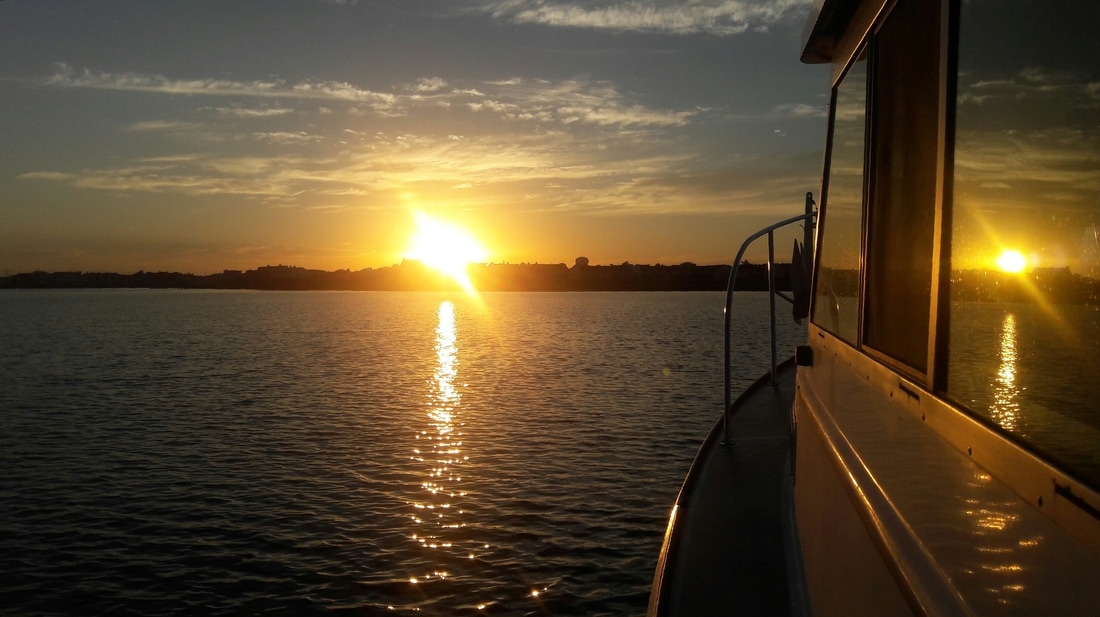  Sunrise   Leaving Atlantic City  Don't know what their looking for...oysters? clams? Anyone know? 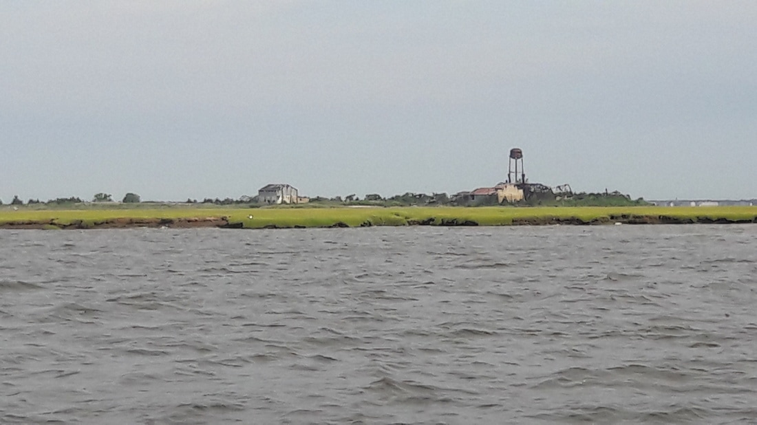 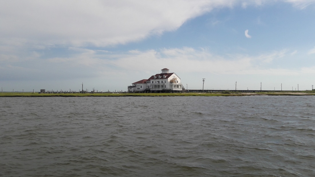 Scenery along the ICW Beach Haven, NJ Top left- a New Jersey dinghy dock All the rest were taken at Island Beach State Park.   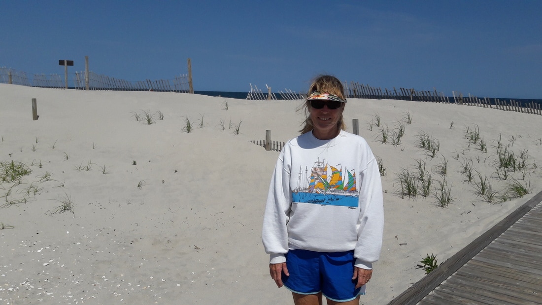 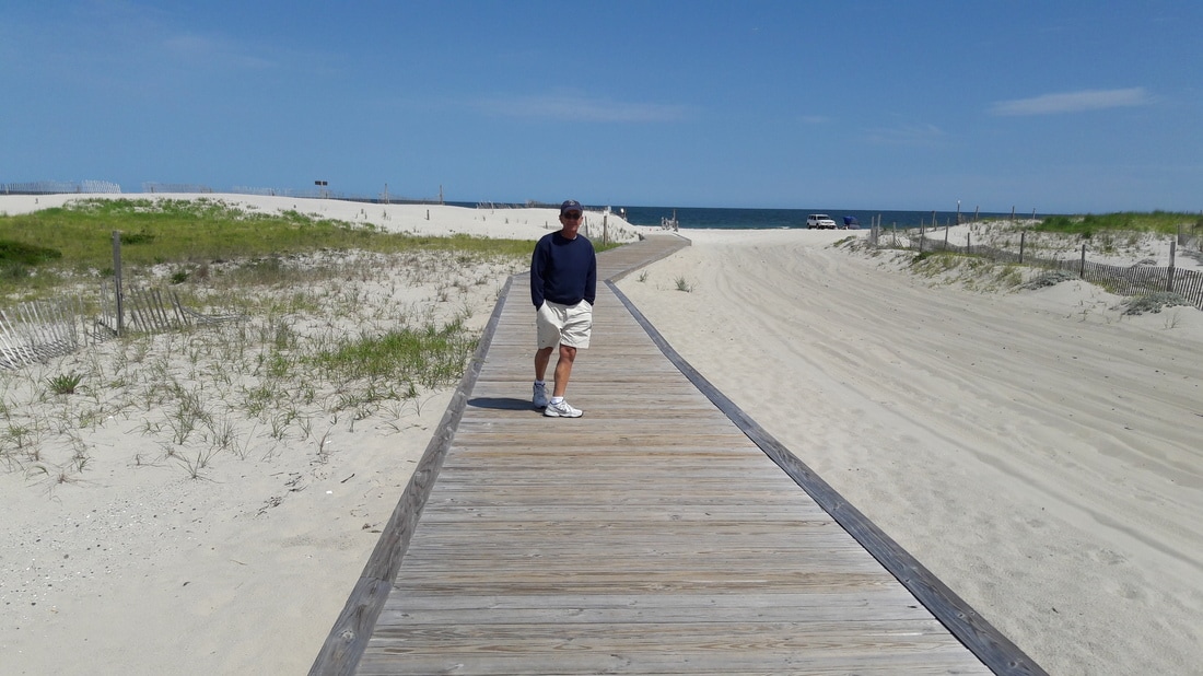 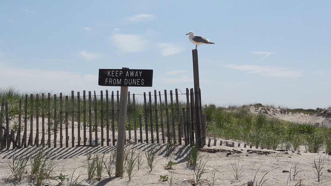 A seagull guarding the dunes. 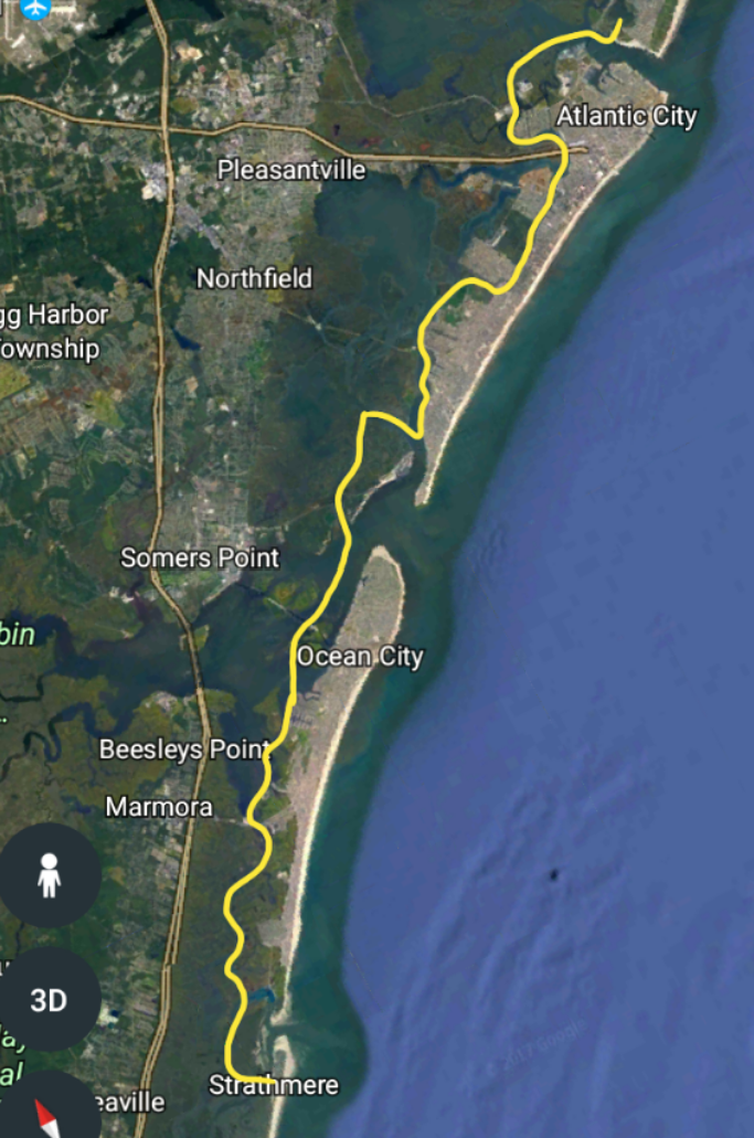  We were up at 6:00. After looking at the weather forecast for the next several days, we decided to pick up our northward pace and wait in Manasquan for our chance to cross to NYC. When I went outside to pick up the anchor, I saw that the boat was covered with little bugs. They were too big to get through the screens into the boat and they didn't bite but they were everywhere and swarming when I was on the bow. The anchor and rode came up with no mud and only minimal vegetation on it. The only problem was the the chain was kinking and I had to manually untwist it before it went through the windlass. In five minutes, we were on our way, or so we thought. The tide was rising but it was low tide and the water depths were very low. Matt attempted to find a suitable deep water path to the ICW, but without success. We decided re-anchor. Once the anchor was down, we enjoyed a leisure morning while we waited for the water to rise. After breakfast, we spent some time doing book keeping, confirming our credit card charges and paying bills. At 8:00, the NE winds increased to 16 kts but the sun was still shining. I looked at the weather radar and saw nothing around us, although a couple storm cells were passing 25 miles north of us. At 10:00, we were now 2ft above MLW. We picked up the anchor and carefully navigated our way through the creek onto the ICW. On the ICW, there were shoal spots that would have challenged Blue Moon's 3ft draft if it wasn't almost high tide. We followed the twists and turns of the ICW toward Atlantic City and arrived at 14:00. We planned to anchor out. It would have been a challenge to get in and out of the slip in the intense winds and with the tide ripping through. The anchorage nearest Atlantic City was on the main drag and near the ocean inlet. The anchorage that we chose was further away but sounded nicer There was a large dredging barge anchored in front of the entrance to the anchorage. Once we got around that and through the narrow canal, it widen up into a large anchorage. To our surprise, there were three other cruising boats there. We haven't seen many of those since we've entered NJ. The wind was still blowing and the tide was still strong. We attempted to set the anchor twice without success. The bottom was grass on black silky messy mud. We moved to a different spot and this time the anchor caught. We decided not go to shore. We didn't feel comfortable leaving the boat unattended in this wind plus we didn't want to go for a .7nm dinghy ride across the inlet with a strong outgoing tide in 15kt winds. Instead, I desalted the stainless railings and windows, refilled the alcohol for the stove, and did other boat chores that needed tending to. Matt took this opportunity to relax. He was at the helm all day and needed a break. This area isn't a relaxing place to cruise through. The wind finally started to decrease around dinner time. After happy hour, we enjoy a spaghetti dinner on the back porch. We continue to watch the weather and wait. Trip Log-Day 51: 25nm, 5 hours, Trip Total: 1406nm, 215.75 hours, 311 gal diesel. 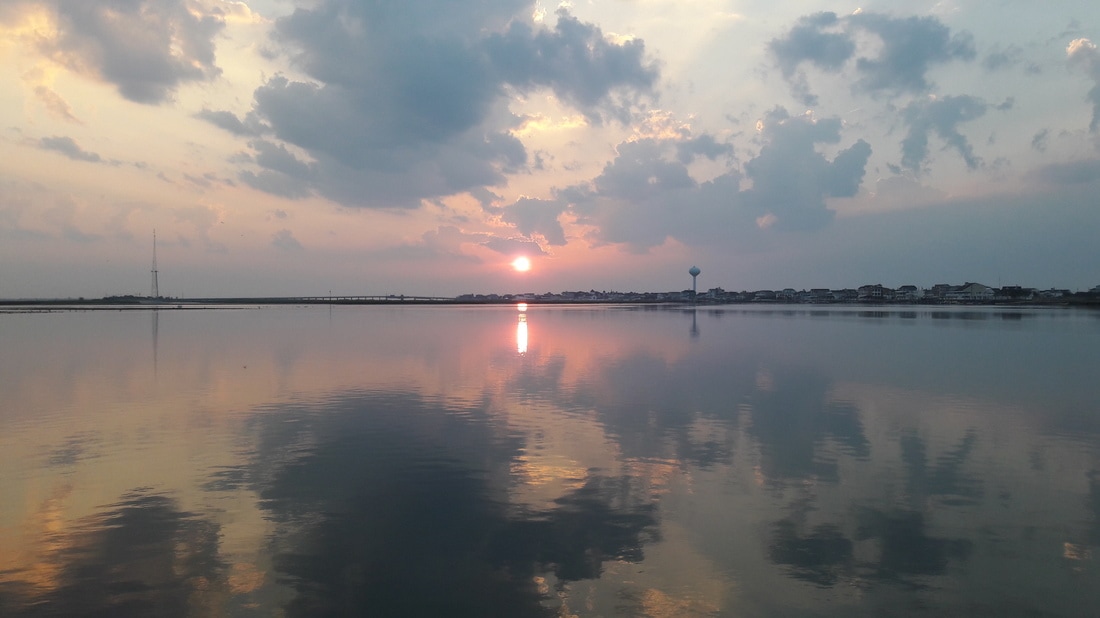 I like the reflections of the clouds on the water in this photo 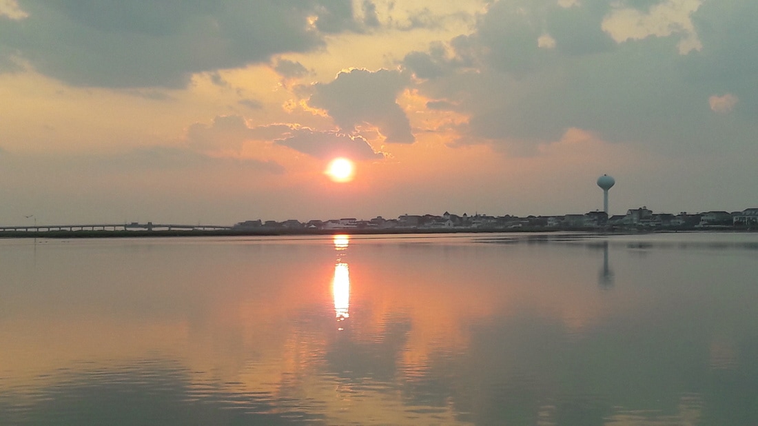 More sunrises.  New Jersey teens with nothing to do 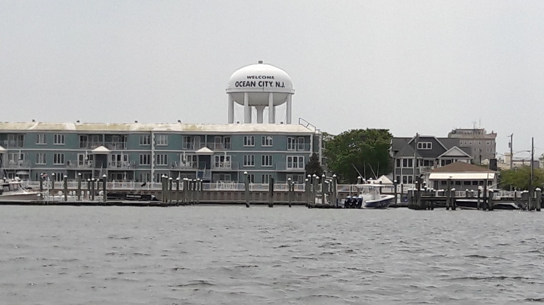 We're passing Ocean City.  Now we're passing through Margate  The Margate Bridge 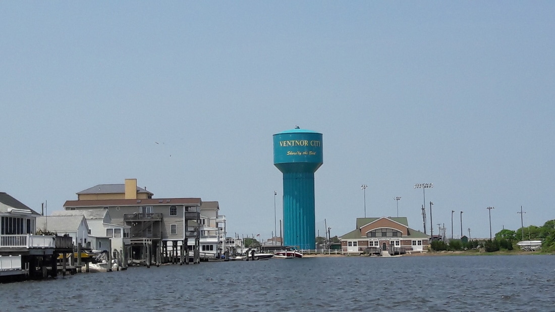 Nice that they put up signs so we know where we are.  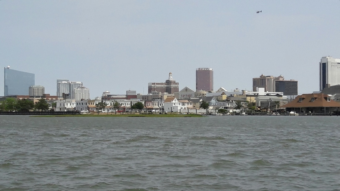 Atlantic City 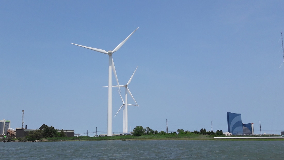 Wind generators near Atlantic City. 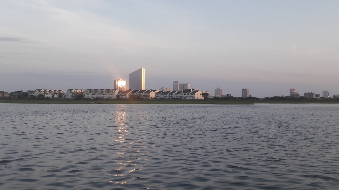 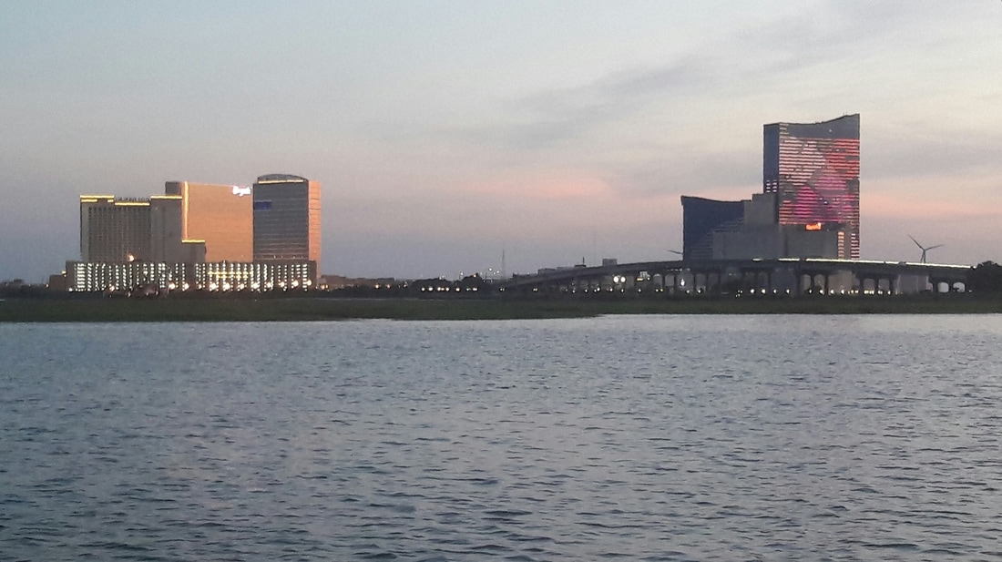 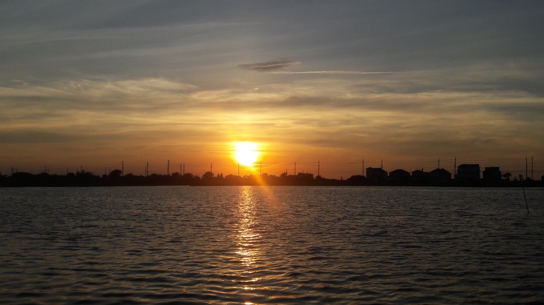 Tonight's sunset 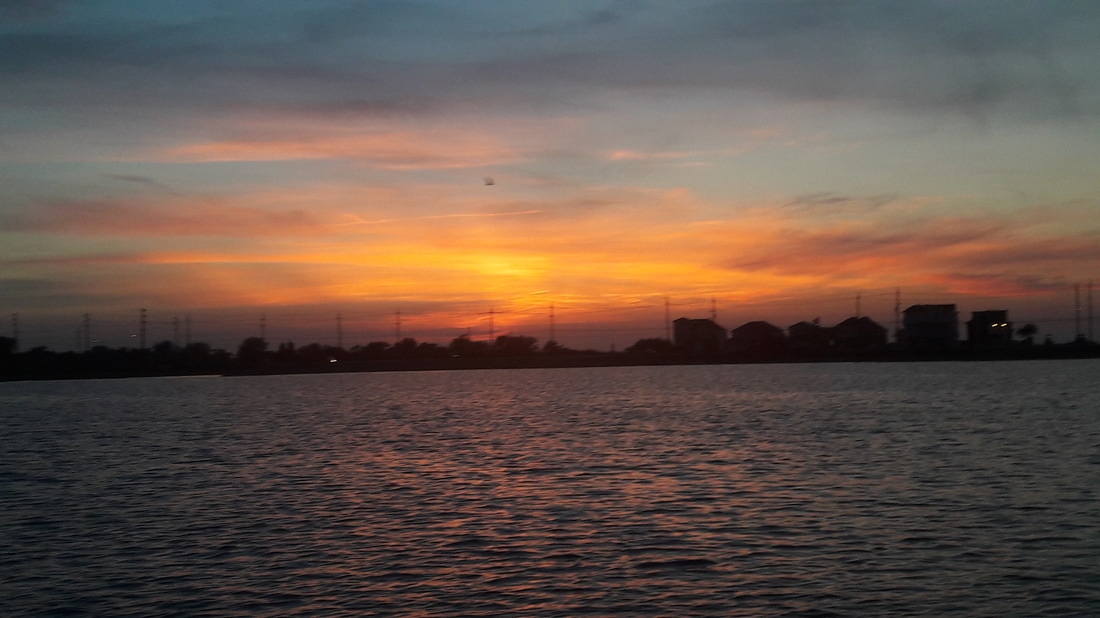 Afterglow   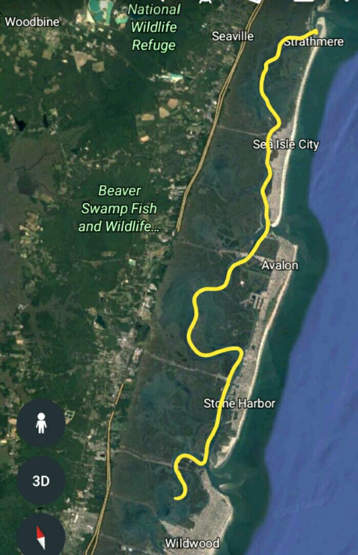 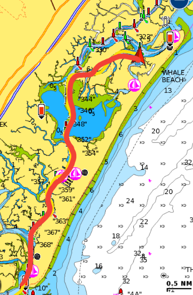 Blue Moon anchored in Whale Creek Today is the 50th day of our cruise. Time has gone by very quickly. Last night, the no see-ums were so intense that we closed up the boat except for the V-berth hatch. We kept that hatch open and used a special no see-ums screen that I made five years ago after our last trip up the east coast. We've never had the need to use it, but it was good to have last night. The cool air got inside and the bugs stayed outside. Since we planned on going only 14 miles today, we had decided to sleep in. We ended up waking at 6:00 anyway. The temperature this morning was cool and a nice breeze blew the no see-ums away so we were able to enjoy our breakfast on the back porch. At 10:15, we started the process of picking up the anchor. There was at least a bushel of seaweed and vegetation clinging to the rode and chain. It was a very slow process picking off the seaweed as we raised the anchor. Fifteen minutes later, we were on our way. There were lots of small boats on the water for a weekday and it seemed like they all were anchored in the middle of the channel fishing. There has been reports of shoaling on the New Jersey ICW. Along our route today, we saw areas of 6-7ft of water and it was 3 ft above MLW, which meant that at low tide, the water depths are only 3-4 ft. I've read on the Active Captain web site that the shoaling gets worse as we head north, for this reason, we plan to be motoring only on a rising tide. We reached Whale Creek at 13:00 and dropped the hook. This creek looks pretty much like yesterday's anchorage except that this one is closer to civilization. There isn't any dinghy access at the nearby town of Strathmere (or on most of the out islands). We're finding that New Jersey isn't that boater friendly. They don't have community dinghy docks and the State and municipal marinas charge $3/ft to dock a boat for the night. We spent the afternoon reading and relaxing. The sea breeze increased throughout the day which kept the temperatures very comfortable. For dinner, Matt barbacued pork tenderloin. We haven't seen any other boats at anchor. Reading the cruising guides, I learned that most cruisers go on the outside and pretty much skip New Jersey except for a night in Atlantic City to break the trip up. The weather forecast continues to be for increased winds and chance of showers for the next week. Our plan continues to be to slowly work our way up to Manasquan, which is 90 miles away, then just wait for a weather window to head to New York. Trip Log-Day 50: 14nm, 2.75 hours, Trip Total: 1381nm, 210.75 hours, 311 gal diesel. 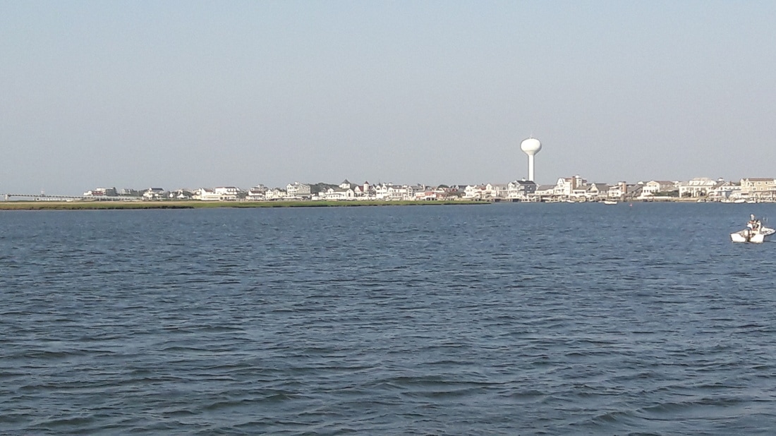 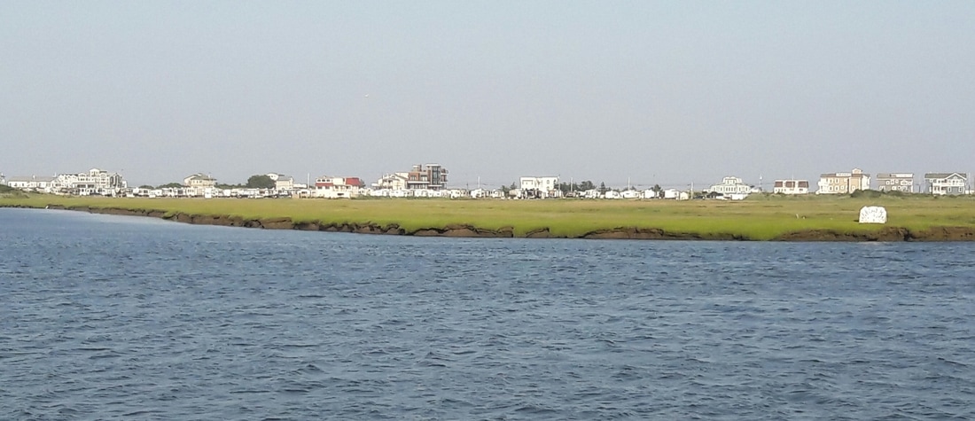 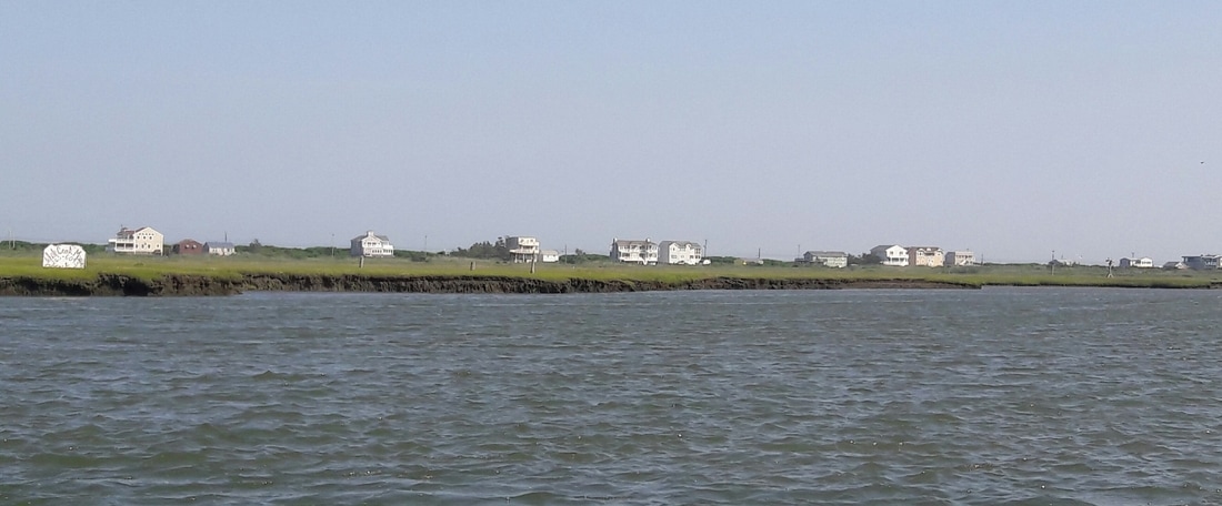  Tonight's neighborhood 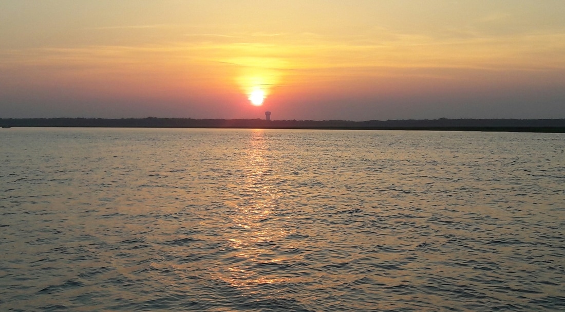 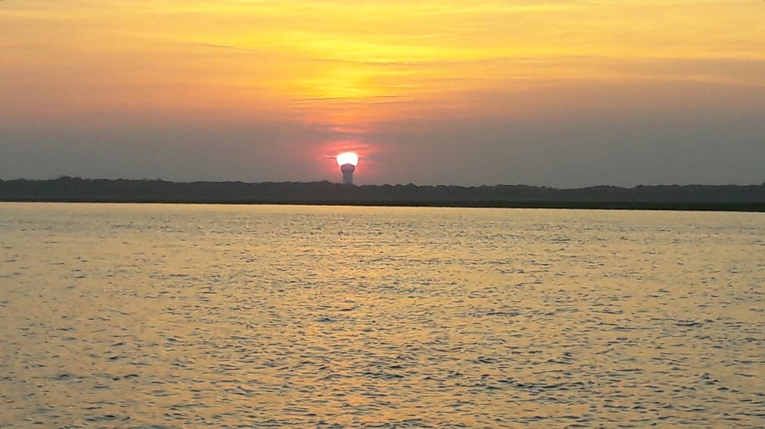 i missed sunrise, buy i did get some sunset photos 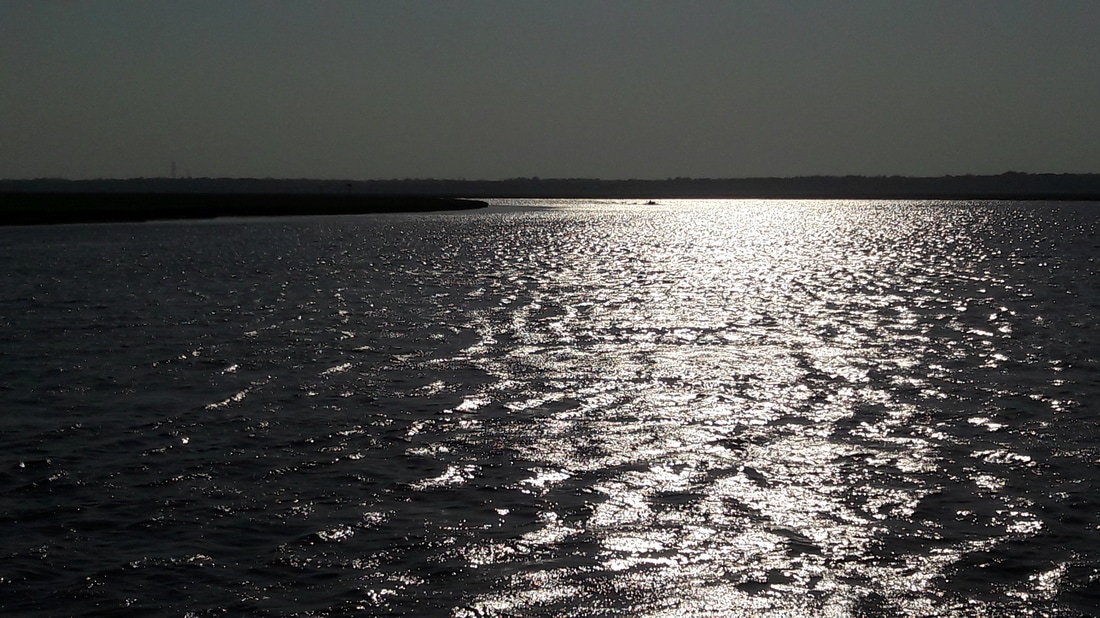  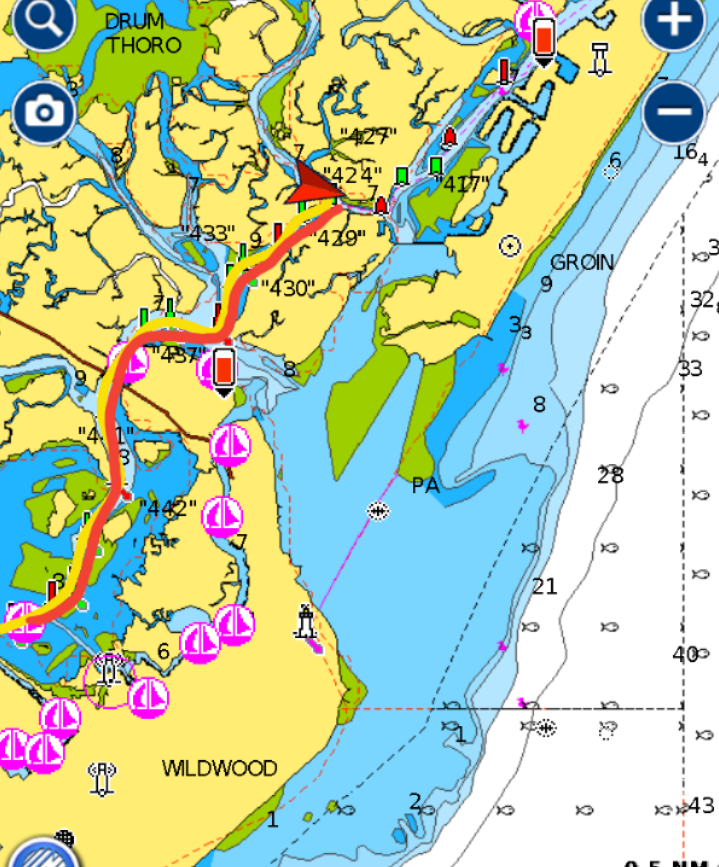 We wanted to get going at first light this morning. The tide would be going out and if we left early, we could ride the tide for several hours before we had to fight it again. It was 35nm down the Delaware Bay to Cape May. At 4:45, we woke up. We were ready to depart. All we needed was a little daylight. At 5:15, we were pulling up the anchor which was more of a challenge with the tide ripping through the anchorage. By 5:30, we were on the Delaware Bay and heading SE. Traveling with the tide, we were going 8 kts. Since the Delaware Bay is wide here, the tide isn't as strong as we experienced yesterday on the narrow part of the bay. We had a good run down the bay. It was cool, sunny and a very light wind was blowing. We arrived at Cape May at 10:00 and entered the cut to the ICW. The anchorage, Sunset Lake, was only a few miles from the cut. We followed the cruising guide's instructions to the anchorage but it lead us past what we thought would be the anchorage. It was odd that there were no boats there. I checked the Active Captain web site for clarification. It said that the Sunset Lake anchorage now has an anchor ban in place. (Just like the Sunset Lake in Miami). So we moved on. We found another possible anchorage 6nm further away. It was what they called a "bird sanctuary", but in reality it was a bunch of seagulls squawking. Once anchored, Matt headed to the bunk for a nap, while I sat out on the back porch reading. For the remainder of the day, we were very lazy. The no see-ums chased us into the boat before sunset. I thought that no see-ums were only down south. It looks like we'll be in New Jersey for awhile. The winds are suppose to be increasing and coming from the East which is not favorable for the outside run up to New York City. So we plan to slowly make our way up the Jersey ICW waiting for a weather window. Trip Log-Day 49: 45nm, 7 hours, Trip Total: 1367nm, 208 hours, 311 gal diesel. 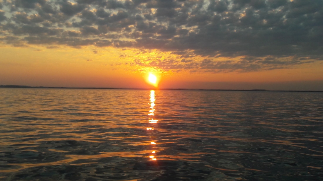 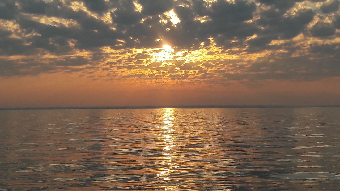 Today's sunrise on the Delaware Bay  Entering the ICW at Cape May. 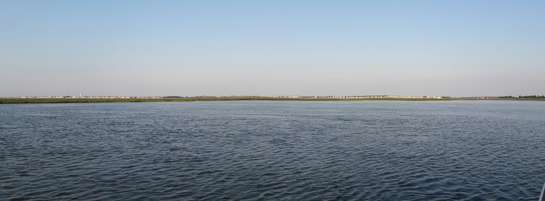 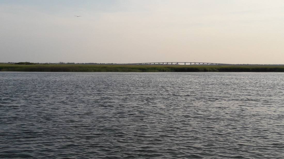 Tonight's views from our back porch. 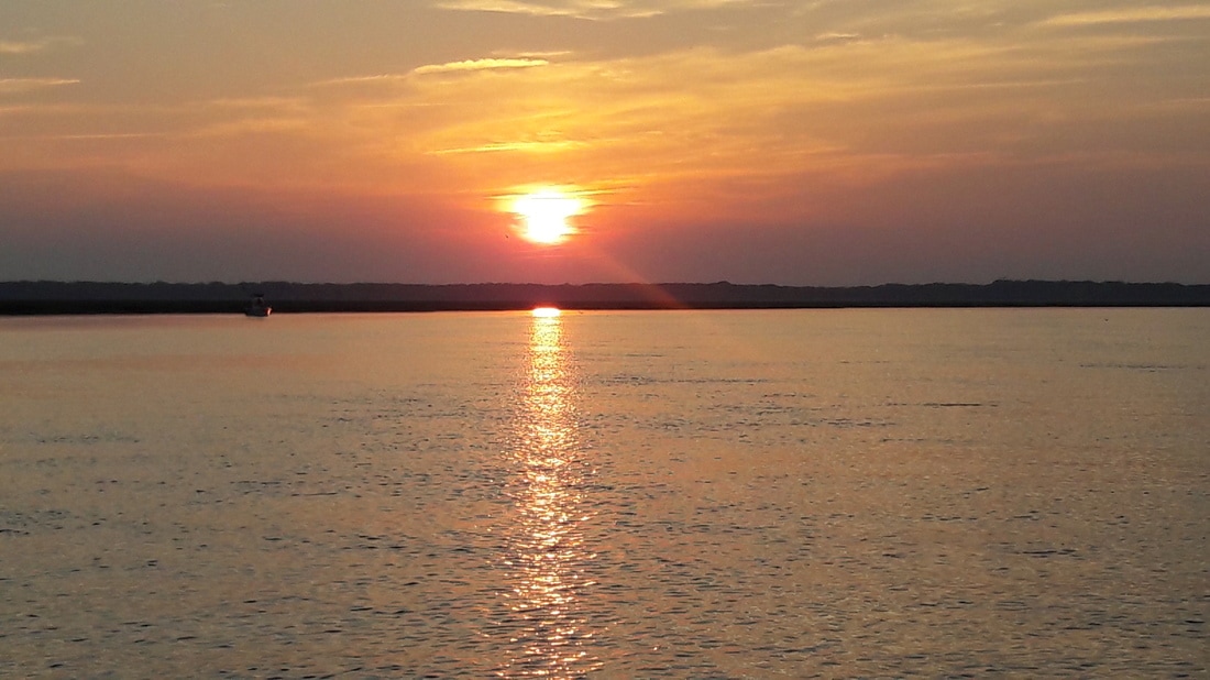 Tonight's sunset. 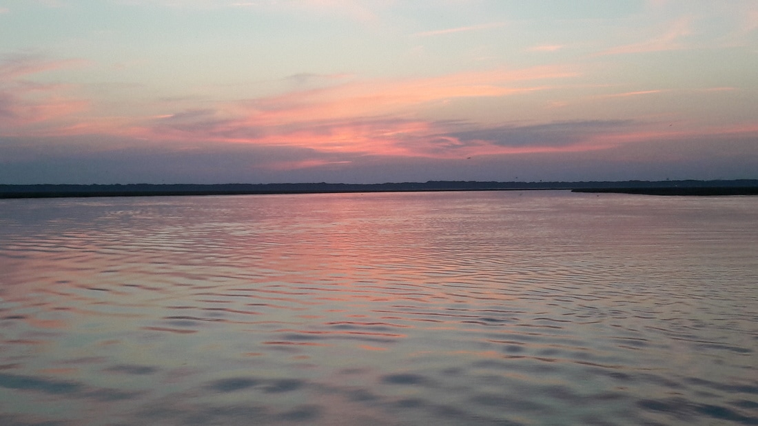 Sunset afterglow |


